|
search place name
|
||
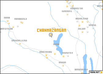
Chāh Mazangān (Kermān, Iran)Chāh Mazangān is a town in the Kermān region of Iran. An overview map of the region around Chāh Mazangān is displayed below.
regional and 3d topo map of Chāh Mazangān, Iran ::
Chāh Mazangān airports ::
The nearest airport is KER - Kerman, located 171.6 km north of Chāh Mazangān.
Other airports nearby include BND - Bandar Abbass Intl (215.6 km south west), Nearby towns ::
Gar (2.1km north) //
Genāb (4.1km south east) //
Damāgh Karam (6.2km south) //
Ḩoseynābād (6.8km south) //
Zeynalābād (7.6km south) //
Sar Gaz (7.9km south east) //
Shūrū'īyeh (8.7km south east) //
Kūnemeng (9.6km north east) //
[all distances 'as the bird flies' and approximate]  Places with similar names to Chāh Mazangān, Iran ::
// Chamsang-ni (KP)
// Chamsŏng-ni (KP)
Disclaimer :: Information on this page comes without warranty of any kind |
||
|
Where is Chāh Mazangān? Elevation and coordinates ::
Latitude (lat): 28°50'1"N Longitude (lon): 57°35'57"E
Elevation (approx.): 1067m (map arrows pan, magnifying glasses zoom) |
||
|
Visiting Chāh Mazangān? Hotel/Accommodation ::
Book a hotel in Chāh Mazangān Travel Guide ::
Buy a travel guide for Iran rental cars ::
car rental offers GPS waypoint ::
download a GPX waypoint (PoI) of Chāh Mazangān for your GPS receiver
|
||