|
search place name
|
||
Chāh Mūsh (Iran)Chāh Mūsh is a town in Iran. An overview map of the region around Chāh Mūsh is displayed below.
regional and 3d topo map of Chāh Mūsh, Iran ::

Chāh Mūsh airports ::
The nearest airport is XBJ - Birjand, located 70.6 km south of Chāh Mūsh.
Nearby towns ::
Teklāteh (1.5km west) //
Kalkīkh (2.4km east) //
Khūnīk-e Pā Godār (4.0km north west) //
Vorenjān (5.2km north west) //
Tak Rūd (5.0km west) //
Panbeh Sūz (5.7km south) //
Gīvrah (5.3km east) //
Khorvāj (6.3km north) //
Kalāteh-ye Chalūnak (6.4km south) //
‘Eshqābād (6.5km north west) //
Sarāb (6.3km west) //
Bīd Meshk (7.6km north) //
Khosravī (7.2km north west) //
Na‘l Kandal (7.2km south west) //
Kalāteh-ye Now (7.8km north west) //
Kalāteh-ye Ḩaq Khvāh (8.4km north west) //
Anjūl (8.6km north west) //
Kalāteh-ye Bāzīch (9.1km north west) //
[all distances 'as the bird flies' and approximate] 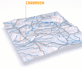 Places with similar names to Chāh Mūsh, Iran ::
Disclaimer :: Information on this page comes without warranty of any kind |
||
|
Where is Chāh Mūsh? Elevation and coordinates ::
Latitude (lat): 33°32'0"N Longitude (lon): 59°13'0"E
Elevation (approx.): 1888m (map arrows pan, magnifying glasses zoom) |
||
|
Visiting Chāh Mūsh? Hotel/Accommodation ::
Book a hotel in Chāh Mūsh Travel Guide ::
Buy a travel guide for Iran rental cars ::
car rental offers GPS waypoint ::
download a GPX waypoint (PoI) of Chāh Mūsh for your GPS receiver
|
||