|
search place name
|
||
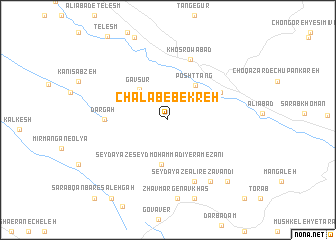
Chālāb-e Bekreh (Ostān-e Kermānshāh, Iran)Chālāb-e Bekreh is a town in the Ostān-e Kermānshāh region of Iran. An overview map of the region around Chālāb-e Bekreh is displayed below.
regional and 3d topo map of Chālāb-e Bekreh, Iran ::
Chālāb-e Bekreh airports ::
The nearest airport is KSH - Bakhtaran Shahid Ashrafi Esfahani, located 79.1 km east of Chālāb-e Bekreh.
Other airports nearby include SDG - Sanandaj (138.3 km north east), Nearby towns ::
Sarjāmeh Shūrān (3.2km north west) //
Gāv Sūr (4.4km north west) //
Posht Tang (4.6km north east) //
Şeyd Ayāz-e Şeyd Moḩammadī-ye Rameẕānī (5.0km south) //
Fīrūzābād (5.7km north east) //
Dargah (5.8km west) //
Khosrowābād (7.0km north) //
Şeyd Ayāz-e ‘Alīreẕā Vandī (7.3km south) //
Şeyd Ayāz-e Shīrzādī (7.9km south east) //
Zhāv Marg-e Nāv Khāş (8.8km south) //
Zhāv Marg-e Moḩammad Morād (8.8km south) //
Zhāv Marg-e Khalīfeh (9.0km south) //
Şeyd Ayāz-e Bāqerī (8.8km south east) //
Sarāb Qanbar-e Shahīd Hādīān (10.2km south west) //
Koreh Jūb (10.2km south west) //
Sarāb Qanbar-e Şāleḩgah (11.0km south west) //
Şeyed Ayāz-e Beyg Reẕā'ī (11.2km south east) //
[all distances 'as the bird flies' and approximate] 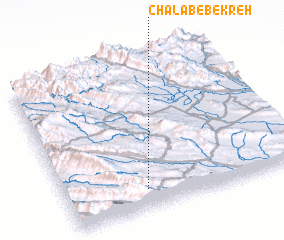 Places with similar names to Chālāb-e Bekreh, Iran :: Disclaimer :: Information on this page comes without warranty of any kind |
||
|
Where is Chālāb-e Bekreh? Elevation and coordinates ::
Latitude (lat): 34°7'42"N Longitude (lon): 46°20'25"E
Elevation (approx.): 1451m (map arrows pan, magnifying glasses zoom) |
||
|
Visiting Chālāb-e Bekreh? Hotel/Accommodation ::
Book a hotel in Chālāb-e Bekreh Travel Guide ::
Buy a travel guide for Iran rental cars ::
car rental offers GPS waypoint ::
download a GPX waypoint (PoI) of Chālāb-e Bekreh for your GPS receiver
|
||