|
search place name
|
||
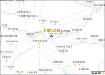
Chālākī (Khorāsān, Iran)Chālākī is a town in the Khorāsān region of Iran. An overview map of the region around Chālākī is displayed below.
regional and 3d topo map of Chālākī, Iran ::
Chālākī airports ::
The nearest airport is ASB - Ashkhabad Ashgabat, located 99.9 km north of Chālākī.
Nearby towns ::
Besh Bāghān (1.3km west) //
Āb Barg (1.9km north west) //
Qeyţāqī (1.9km east) //
Dāghbān Mezerj (3.1km north west) //
Zalābād (4.5km south) //
Aq Kahrīz (4.8km north) //
Parīābād (4.1km east) //
Farkhān-e Soflā (4.2km south west) //
Hey Hey (4.1km west) //
Yūsef Khān (4.2km east) //
Farkhān-e Soflá (5.2km south east) //
Kalāteh-ye Ḩājjī Barāt (5.2km south east) //
Farrokhābād (4.8km south west) //
Farkhān-e Kohneh (4.8km south west) //
Farkhān-e Shāhrāh (5.1km south west) //
Mezerj (5.9km north west) //
Dīzāvand (6.5km south east) //
Qūchān (6.3km west) //
Bād Khvor (7.3km east) //
Fakhrābād (8.3km north west) //
Shūrok-e Tūpkānlū (9.6km north west) //
[all distances 'as the bird flies' and approximate]  Places with similar names to Chālākī, Iran ::
// Choulic (US)
// Shell Lake (US)
// Chilco (US)
// Chalgah (IQ)
// Chālgah (IQ)
// Chalkī (IQ)
// Chālkī (IQ)
// Challga (IQ)
// Siołko (PL)
// Wychylówka (PL)
Disclaimer :: Information on this page comes without warranty of any kind |
||
|
Where is Chālākī? Elevation and coordinates ::
Latitude (lat): 37°6'14"N Longitude (lon): 58°34'51"E
Elevation (approx.): 1353m (map arrows pan, magnifying glasses zoom) |
||
|
Visiting Chālākī? Hotel/Accommodation ::
Book a hotel in Chālākī Travel Guide ::
Buy a travel guide for Iran rental cars ::
car rental offers GPS waypoint ::
download a GPX waypoint (PoI) of Chālākī for your GPS receiver
|
||