|
search place name
|
||
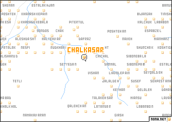
Chalkā Sar (Gīlān, Iran)Chalkā Sar is a town in the Gīlān region of Iran. An overview map of the region around Chalkā Sar is displayed below.
regional and 3d topo map of Chalkā Sar, Iran ::
Chalkā Sar airports ::
The nearest airport is RAS - Rasht, located 56.5 km north of Chalkā Sar.
Other airports nearby include RZR - Ramsar (93.9 km east), THR - Teheran Mehrabad Intl (196.1 km south east), Nearby towns ::
Gonbak (1.9km north) //
Chorreh (2.4km north west) //
Kūreh (2.4km south west) //
Ḩājjī Deh (2.4km south west) //
Rashī (2.4km north east) //
Dafrāz (3.7km north) //
Chīchāl (3.0km east) //
Pasīn Darreh (3.5km north west) //
Seyyedān (3.5km south west) //
Sī Dasht (3.5km north east) //
Vīshān (4.0km south) //
Dasht-e Veyl (4.7km north west) //
Chombol (4.7km south east) //
Shīr Kadeh (4.7km south east) //
Rūdkhāneh (4.8km north west) //
Tīrkālashk (5.8km north) //
Ḩājjī Shīrkīā (4.8km south west) //
Sarmal (4.8km south east) //
Shīr Kūh (7.2km north) //
Pītertūl (7.6km north) //
Kūlīdahān (6.2km west) //
Makhshar (6.2km west) //
Lūrī Sar (6.2km west) //
Chāk (7.1km north west) //
Āsīāb Dasht (7.1km north west) //
Jalāl Deh (7.1km south east) //
Ḩalyehvar (7.0km north west) //
Balkeh Sar (8.0km south) //
Līāvol-e Pāʼīn (7.0km south east) //
[all distances 'as the bird flies' and approximate]  Places with similar names to Chalkā Sar, Iran ::
Disclaimer :: Information on this page comes without warranty of any kind |
||
|
Where is Chalkā Sar? Elevation and coordinates ::
Latitude (lat): 36°49'0"N Longitude (lon): 49°38'0"E
Elevation (approx.): 871m (map arrows pan, magnifying glasses zoom) |
||
|
Visiting Chalkā Sar? Hotel/Accommodation ::
Book a hotel in Chalkā Sar Travel Guide ::
Buy a travel guide for Iran rental cars ::
car rental offers GPS waypoint ::
download a GPX waypoint (PoI) of Chalkā Sar for your GPS receiver
|
||