|
search place name
|
||
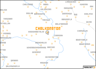
Chāl Korātor (Ostān-e Kohgīlūyeh va Būyer Aḩmad, Iran)Chāl Korātor is a town in the Ostān-e Kohgīlūyeh va Būyer Aḩmad region of Iran. An overview map of the region around Chāl Korātor is displayed below.
regional and 3d topo map of Chāl Korātor, Iran ::
Chāl Korātor airports ::
The nearest airport is MRX - Bandar Mahshahr Mahshahr, located 118.8 km west of Chāl Korātor.
Other airports nearby include AWZ - Ahwaz (163.4 km west), QMJ - Masjed Soleiman Shahid Asyaee (168.4 km north west), BUZ - Bushehr (211.1 km south), Nearby towns ::
Balūţ Ḩeşār (1.9km south) //
Godār Narkūn (2.0km south east) //
Seh Gonbadān (3.5km south east) //
Do Khās-e ‘Olyā (3.7km south) //
Cham Sīāh (3.7km east) //
Khowsh Āb-e Talkh (4.0km west) //
Tarzdūn (4.7km north) //
Bāgh-e Malek (4.7km south west) //
Barzīān (6.0km south) //
Balūţ Bangān (5.6km north east) //
Dār Boland (5.5km west) //
Kafshkanān (5.5km west) //
Alvand Sagtan (6.6km north) //
Deh-e ‘Abdeh Moḩammad (7.1km south west) //
Borm-e Sefīd (7.7km north) //
Khowsh Āb-e Shīrīn (7.2km west) //
Ābmū Soflá (8.0km north east) //
Kalgeh Zarī (8.9km north) //
Deh-e Amīr (8.7km south west) //
Eshkaf Derāz (8.8km north west) //
Dūl Barfī (9.4km north west) //
Rag Lāb (9.6km north west) //
Darreh Dū‘ī (9.6km north east) //
[all distances 'as the bird flies' and approximate]  Places with similar names to Chāl Korātor, Iran :: Disclaimer :: Information on this page comes without warranty of any kind |
||
|
Where is Chāl Korātor? Elevation and coordinates ::
Latitude (lat): 30°48'12"N Longitude (lon): 50°21'28"E
Elevation (approx.): 746m (map arrows pan, magnifying glasses zoom) |
||
|
Visiting Chāl Korātor? Hotel/Accommodation ::
Book a hotel in Chāl Korātor Travel Guide ::
Buy a travel guide for Iran rental cars ::
car rental offers GPS waypoint ::
download a GPX waypoint (PoI) of Chāl Korātor for your GPS receiver
|
||