|
search place name
|
||
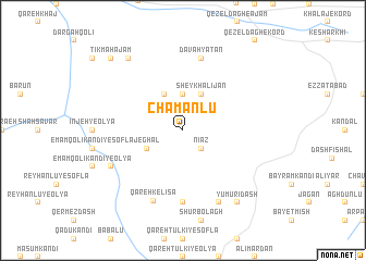
Chamanlū (Ostān-e Āz̄arbāyjān-e Gharbī, Iran)Chamanlū is a town in the Ostān-e Āz̄arbāyjān-e Gharbī region of Iran. An overview map of the region around Chamanlū is displayed below.
regional and 3d topo map of Chamanlū, Iran ::
Chamanlū airports ::
The nearest airport is VAN - Van, located 134.7 km south west of Chamanlū.
Other airports nearby include TBZ - Tabriz Intl (182.8 km south east), Nearby towns ::
Nīāz (2.3km south east) //
Āghbolāgh-e Chamanlū (3.7km north) //
Sheykh‘alījān (4.0km north) //
Māyel Kandī (4.0km north) //
Jeghāl (3.4km south west) //
Moḩammad Āqā-ye ‘Olyā (7.4km south) //
Davahyātān (7.6km north) //
Qareh Kelīsā (7.6km south) //
Āghdāsh (8.0km south) //
Ābārābāshī (6.8km south west) //
Kārvān Qorān (8.6km north west) //
Yūmūrīdāsh (8.6km south east) //
Tīkmah ‘Ajam (9.4km north west) //
[all distances 'as the bird flies' and approximate]  Places with similar names to Chamanlū, Iran ::
// Cham Nīleh (IR)
// Tiamnal (MX)
// Tiamène Oualo (SN)
// Siamunali (ZM)
// Shamanlī (SY)
// Chimbonila (MZ)
// Shimenlou (CN)
// Shimenlou (CN)
// Shimenlou (CN)
Disclaimer :: Information on this page comes without warranty of any kind |
||
|
Where is Chamanlū? Elevation and coordinates ::
Latitude (lat): 39°10'0"N Longitude (lon): 44°36'0"E
Elevation (approx.): 2233m (map arrows pan, magnifying glasses zoom) |
||
|
Visiting Chamanlū? Hotel/Accommodation ::
Book a hotel in Chamanlū Travel Guide ::
Buy a travel guide for Iran rental cars ::
car rental offers GPS waypoint ::
download a GPX waypoint (PoI) of Chamanlū for your GPS receiver
|
||