|
search place name
|
||
Cham Chūl (Lorestān, Iran)Cham Chūl is a town in the Lorestān region of Iran. An overview map of the region around Cham Chūl is displayed below.
regional and 3d topo map of Cham Chūl, Iran ::

Cham Chūl airports ::
The nearest airport is KSH - Bakhtaran Shahid Ashrafi Esfahani, located 88.8 km north of Cham Chūl.
Other airports nearby include SDG - Sanandaj (188.2 km north), Nearby towns ::
Cheshmeh Sefīd (1.5km east) //
Chāh Kheyr (1.5km east) //
Zūleh (2.4km north east) //
Atābakī (4.6km west) //
Chākaram Khān (4.6km west) //
Sīāh Pelah-ye Mīnā (5.6km north) //
Kūl Bādām-e Yāvar (5.9km north west) //
Kūl Bādām-e Nūrmorād (5.9km north west) //
Chāpʼīt-e Soflá (5.9km south east) //
Choqā Peyat-e ‘Olyā (5.9km south east) //
Sīāh Pelah-ye Parvīz (7.6km north) //
Kamūl-e Rostam Beygī (7.2km north west) //
Kamūl-e Karam Khānī (7.2km north west) //
Bārīkeh-ye Farkhīnehvand (8.0km north west) //
Cham Būr-e Farkhīnvand (8.0km north west) //
Qebleh (7.3km east) //
Kamūl-e Bābā Khānī (8.3km north west) //
Laţīf (8.3km south east) //
Chāh Derāznā (8.3km south east) //
Baleyn (8.7km north east) //
Posht Kabūd (9.6km north west) //
[all distances 'as the bird flies' and approximate] 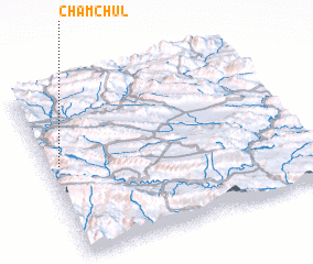 Places with similar names to Cham Chūl, Iran ::
// Cham Chāl (IR)
// Chamchāl (IR)
// Shamshaly (KG)
// Shimshāl (PK)
// Shemishal (HN)
// Ch'imch'ol-li (KP)
// Ch'imch'ol-li (KP)
// Chŏmch'ol-li (KP)
// Chamyshelʼ (BY)
Disclaimer :: Information on this page comes without warranty of any kind |
||
|
Where is Cham Chūl? Elevation and coordinates ::
Latitude (lat): 33°33'0"N Longitude (lon): 47°3'0"E
Elevation (approx.): 1073m (map arrows pan, magnifying glasses zoom) |
||
|
Visiting Cham Chūl? Hotel/Accommodation ::
Book a hotel in Cham Chūl Travel Guide ::
Buy a travel guide for Iran rental cars ::
car rental offers GPS waypoint ::
download a GPX waypoint (PoI) of Cham Chūl for your GPS receiver
|
||