|
search place name
|
||
Cham-e Shūr (Khūzestān, Iran)Cham-e Shūr is a town in the Khūzestān region of Iran. An overview map of the region around Cham-e Shūr is displayed below.
regional and 3d topo map of Cham-e Shūr, Iran ::

Cham-e Shūr airports ::
The nearest airport is QMJ - Masjed Soleiman Shahid Asyaee, located 17.8 km south west of Cham-e Shūr.
Other airports nearby include AWZ - Ahwaz (104.4 km south west), MRX - Bandar Mahshahr Mahshahr (171.4 km south), ABD - Abadan (221.9 km south west), BSR - Basrah Intl (239.5 km south west), Nearby towns ::
Shahrak-e Yāser (0.0km north) //
Chehshūr (1.6km west) //
Ja‘farābād (1.9km south) //
Sar Gach (1.6km west) //
Ḩoseyn Qolī (2.4km south west) //
Kalb‘alī ‘Arab (2.4km north east) //
Ābezhdān (3.0km south east) //
Gachvar (3.2km north west) //
Yek Borjī (3.7km south) //
Boneh-ye Eskandar (3.7km south) //
Talkhāb (3.7km south) //
Gorgeh (3.7km north) //
Shahrak-e Ţāleqānī (4.0km south west) //
Mūrd (4.0km south west) //
Reẕā (3.6km south west) //
Gorg ‘Alī Ḩasan (4.0km south west) //
Aḩmadābād-e Sar Tang (4.0km south west) //
Feyẕollāh (4.0km south west) //
Ābezhdān-e Malmūlīn (4.0km south east) //
Āb Qal‘eh (4.0km south east) //
Āqā (4.0km south east) //
Amīr ol Mo'menīn (4.0km south east) //
‘Abd ol Moḩammad (3.6km south east) //
Boneh-ye Gorgī (4.0km north east) //
Shīr Rajab (4.2km south west) //
Bogsī (4.4km west) //
Mashhadī ‘Abd-e Khān (4.9km south west) //
‘Abdī Khān (4.9km south west) //
Seyyed Rajab (4.9km south west) //
[all distances 'as the bird flies' and approximate] 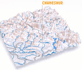 Places with similar names to Cham-e Shūr, Iran ::
// Cham Chīr (IQ)
// Shamshīrah (EG)
// Chemashur (RU)
// Chemoshur (RU)
// Chemoshur (RU)
// Chimoshur (RU)
// Chimoshur (RU)
// Chumoshur (RU)
// Cham Chareh (IR)
// Cham Charū (IR)
Disclaimer :: Information on this page comes without warranty of any kind |
||
|
Where is Cham-e Shūr? Elevation and coordinates ::
Latitude (lat): 32°5'0"N Longitude (lon): 49°26'0"E
Elevation (approx.): 525m (map arrows pan, magnifying glasses zoom) |
||
|
Visiting Cham-e Shūr? Hotel/Accommodation ::
Book a hotel in Cham-e Shūr Travel Guide ::
Buy a travel guide for Iran rental cars ::
car rental offers GPS waypoint ::
download a GPX waypoint (PoI) of Cham-e Shūr for your GPS receiver
|
||