|
search place name
|
||
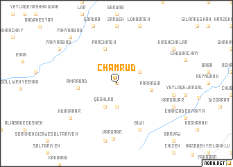
Cham Rūd (Iran)Cham Rūd is a town in Iran. An overview map of the region around Cham Rūd is displayed below.
regional and 3d topo map of Cham Rūd, Iran ::
Cham Rūd airports ::
The nearest airport is RAS - Rasht, located 93.5 km north east of Cham Rūd.
Other airports nearby include RZR - Ramsar (156.7 km east), SDG - Sanandaj (235.6 km south west), Nearby towns ::
Chammeh (0.0km north) //
Paranqūr (3.7km south) //
Bālūf (3.5km north east) //
Qeshlāq (4.0km south) //
Parangīn (4.7km east) //
Parchīneh (5.8km north) //
Amīrābād (5.0km west) //
Būjī (8.0km south) //
Vanūnān (8.8km south) //
Kūh Kamar (8.1km south west) //
Yaḩyáābād (9.5km north west) //
[all distances 'as the bird flies' and approximate] 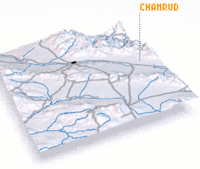 Places with similar names to Cham Rūd, Iran ::
// Chāh Morūd (IR)
// Cham Morād (IR)
// Cham Rīteh (IR)
// Cham Rūd (IR)
// Chāmārdi (BD)
// Chāmrāid (BD)
// Chamārdi (IN)
// Chamrat (IN)
// Shāh Mardī (IR)
// Shāh Morād (IR)
Disclaimer :: Information on this page comes without warranty of any kind |
||
|
Where is Cham Rūd? Elevation and coordinates ::
Latitude (lat): 36°40'0"N Longitude (lon): 48°57'0"E
Elevation (approx.): 1791m (map arrows pan, magnifying glasses zoom) |
||
|
Visiting Cham Rūd? Hotel/Accommodation ::
Book a hotel in Cham Rūd Travel Guide ::
Buy a travel guide for Iran rental cars ::
car rental offers GPS waypoint ::
download a GPX waypoint (PoI) of Cham Rūd for your GPS receiver
|
||