|
search place name
|
||
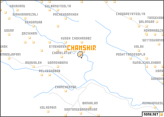
Cham Shīr (Īlām, Iran)Cham Shīr is a town in the Īlām region of Iran. An overview map of the region around Cham Shīr is displayed below.
regional and 3d topo map of Cham Shīr, Iran ::
Cham Shīr airports ::
The nearest airport is KSH - Bakhtaran Shahid Ashrafi Esfahani, located 102.3 km north of Cham Shīr.
Other airports nearby include SDG - Sanandaj (201.1 km north), Nearby towns ::
Choqā Sabz-e Naqd-e ‘Alī (1.6km north) //
Emāmzādeh ‘Abbās (1.9km north) //
Cham-e Zavīyeh (2.4km north west) //
Chokhā Sabz (3.7km north) //
Qabr-e Moḩammad Morād (3.6km north west) //
Cham-e Latūr (3.9km west) //
Kūseh (4.8km north west) //
Darreh Bārīk (5.0km west) //
‘Eyn-e Ḩāreh (5.0km west) //
Cham Rīteh (5.0km west) //
Chamcheh Zar (8.0km south west) //
Pelk-e Shabāb (7.2km south west) //
Cham-e Mīr Beyg (7.2km north west) //
Cham-e Dār Balūţ (7.2km north west) //
Sargel-e Farkhīvand (8.7km north west) //
[all distances 'as the bird flies' and approximate] 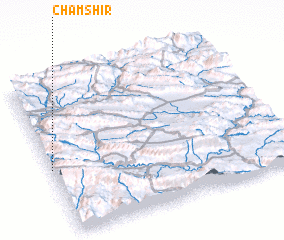 Places with similar names to Cham Shīr, Iran ::
// Cham Chīr (IQ)
// Shamshīrah (EG)
// Chemashur (RU)
// Chemoshur (RU)
// Chemoshur (RU)
// Chimoshur (RU)
// Chimoshur (RU)
// Chumoshur (RU)
// Cham Chareh (IR)
// Cham Charū (IR)
Disclaimer :: Information on this page comes without warranty of any kind |
||
|
Where is Cham Shīr? Elevation and coordinates ::
Latitude (lat): 33°26'0"N Longitude (lon): 47°0'0"E
Elevation (approx.): 721m (map arrows pan, magnifying glasses zoom) |
||
|
Visiting Cham Shīr? Hotel/Accommodation ::
Book a hotel in Cham Shīr Travel Guide ::
Buy a travel guide for Iran rental cars ::
car rental offers GPS waypoint ::
download a GPX waypoint (PoI) of Cham Shīr for your GPS receiver
|
||