|
search place name
|
||
Charmkesh (Gīlān, Iran)Charmkesh is a town in the Gīlān region of Iran. An overview map of the region around Charmkesh is displayed below.
regional and 3d topo map of Charmkesh, Iran ::

Charmkesh airports ::
The nearest airport is RAS - Rasht, located 69.7 km north of Charmkesh.
Other airports nearby include RZR - Ramsar (91.9 km east), THR - Teheran Mehrabad Intl (184.6 km south east), Nearby towns ::
Gīāsh (1.5km east) //
Latān Sar (2.4km north west) //
Talakeh Sar (4.0km north) //
Barīn (4.0km north) //
Chermūl (3.5km north west) //
Chaftābar (4.0km south) //
Khoshkeh Seylī (4.8km north west) //
Dīvkhānī (4.8km north west) //
Gīāsh (5.6km north) //
Sangrūd (5.5km south) //
Balkeh Sar (5.8km north) //
Keyhān (5.8km north) //
Gerdeh Vīsheh (4.8km north west) //
Mīānsū (5.8km north east) //
Now Deh (5.8km south east) //
Sīāh Poshteh (5.8km north west) //
Karamāk-e Bālā (5.8km south west) //
Jalāl Deh (7.4km north) //
Qal‘eh Chān (6.2km west) //
Kūr Cheshmeh (6.2km east) //
Lābārbon (6.2km east) //
Pāk Deh (7.0km south east) //
Māshmīān (8.0km north) //
Līāvol-e Bālā (8.0km north) //
Sūsef (8.6km north east) //
Delālem (8.1km north east) //
Seh Kūreh (8.7km south west) //
[all distances 'as the bird flies' and approximate] 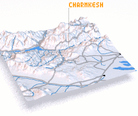 Places with similar names to Charmkesh, Iran ::
// Shirmoksha (RU)
Disclaimer :: Information on this page comes without warranty of any kind |
||
|
Where is Charmkesh? Elevation and coordinates ::
Latitude (lat): 36°42'0"N Longitude (lon): 49°41'0"E
Elevation (approx.): 2221m (map arrows pan, magnifying glasses zoom) |
||
|
Visiting Charmkesh? Hotel/Accommodation ::
Book a hotel in Charmkesh Travel Guide ::
Buy a travel guide for Iran rental cars ::
car rental offers GPS waypoint ::
download a GPX waypoint (PoI) of Charmkesh for your GPS receiver
|
||