|
search place name
|
||
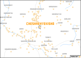
Cheshmeh-ye Kīshā (Kermān, Iran)Cheshmeh-ye Kīshā is a town in the Kermān region of Iran. An overview map of the region around Cheshmeh-ye Kīshā is displayed below.
regional and 3d topo map of Cheshmeh-ye Kīshā, Iran ::
Cheshmeh-ye Kīshā airports ::
The nearest airport is KER - Kerman, located 177.7 km north west of Cheshmeh-ye Kīshā.
Other airports nearby include BND - Bandar Abbass Intl (241.0 km south west), Nearby towns ::
Ker (0.6km north) //
Bāb-e Morvārīd (1.2km south) //
Gīshāb (1.7km east) //
Kamālābād (1.7km west) //
Darreh-ye Chenār (2.0km south west) //
Bondar-e Garm (2.0km south west) //
Jazanābād (2.5km north) //
Joznābād (2.5km north) //
Tūderk (2.3km south west) //
Garm Āb (2.5km west) //
Gorāghān (2.8km south west) //
Sarhangar (3.1km south) //
Sarzeh (3.1km south) //
Zīpā (2.9km west) //
Asbī (3.0km south west) //
Moḩammadābād-e Maskūn (3.1km west) //
Rashtīn (3.5km south west) //
Bāgh-e Anār (3.5km south west) //
Changālī (3.5km south west) //
Boneh-ye Kohan (3.5km south west) //
Boneh-ye Golān (3.5km south west) //
Ḩoseynābād (3.7km north) //
Ḩasanābād (3.7km north west) //
Gorāghān (4.1km south west) //
Afrāz (4.2km north west) //
Zāhedān (3.9km west) //
Gowd Sorkh (4.3km north west) //
Sarcheshmeh (4.6km north) //
Kalamī (4.5km north west) //
[all distances 'as the bird flies' and approximate]  Places with similar names to Cheshmeh-ye Kīshā, Iran :: Disclaimer :: Information on this page comes without warranty of any kind |
||
|
Where is Cheshmeh-ye Kīshā? Elevation and coordinates ::
Latitude (lat): 28°54'40"N Longitude (lon): 57°55'0"E
Elevation (approx.): 2360m (map arrows pan, magnifying glasses zoom) |
||
|
Visiting Cheshmeh-ye Kīshā? Hotel/Accommodation ::
Book a hotel in Cheshmeh-ye Kīshā Travel Guide ::
Buy a travel guide for Iran rental cars ::
car rental offers GPS waypoint ::
download a GPX waypoint (PoI) of Cheshmeh-ye Kīshā for your GPS receiver
|
||