|
search place name
|
||
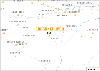
Cheshm-e Kūreh (Eşfahān, Iran)Cheshm-e Kūreh is a town in the Eşfahān region of Iran. An overview map of the region around Cheshm-e Kūreh is displayed below.
regional and 3d topo map of Cheshm-e Kūreh, Iran ::
Cheshm-e Kūreh airports ::
The nearest airport is QMJ - Masjed Soleiman Shahid Asyaee, located 182.4 km west of Cheshm-e Kūreh.
Nearby towns ::
Hārdang (2.9km south east) //
Seh Chāh (3.7km south east) //
Darreh Pūneh'ī (4.2km north east) //
Būdāghābād (4.2km south east) //
Qal‘eh-e Ḩājjī (4.2km east) //
Ganjābād (4.6km north east) //
Kachū'īyeh (4.4km east) //
Cher Mahīn (5.8km north east) //
Qal‘eh Pā'īn (5.6km east) //
Lāy Bīd (7.3km north) //
Chāh-e Anjīr (6.6km west) //
Ḩājat Āqā (7.5km north west) //
Khāk Sefīd (7.6km north east) //
Darreh Dowlī (7.0km west) //
Cham-e Āsemān (8.3km north) //
Zamānābād (7.3km east) //
Shūrcheh (9.2km north east) //
Qal‘eh Āqā (9.4km north west) //
[all distances 'as the bird flies' and approximate]  Places with similar names to Cheshm-e Kūreh, Iran ::
// Cheshmeh Kareh (IR)
// Cheshmeh Kareh (IR)
// Cheshmeh Kareh (IR)
// Cheshmeh Kūreh (IR)
// Cheshmeh Qareh (IR)
// Chuchumicari (MX)
Disclaimer :: Information on this page comes without warranty of any kind |
||
|
Where is Cheshm-e Kūreh? Elevation and coordinates ::
Latitude (lat): 32°17'32"N Longitude (lon): 51°10'25"E
Elevation (approx.): 2028m (map arrows pan, magnifying glasses zoom) |
||
|
Visiting Cheshm-e Kūreh? Hotel/Accommodation ::
Book a hotel in Cheshm-e Kūreh Travel Guide ::
Buy a travel guide for Iran rental cars ::
car rental offers GPS waypoint ::
download a GPX waypoint (PoI) of Cheshm-e Kūreh for your GPS receiver
|
||