|
search place name
|
||
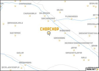
Chop Chop (Iran)Chop Chop is a town in Iran. An overview map of the region around Chop Chop is displayed below.
regional and 3d topo map of Chop Chop, Iran ::
Chop Chop airports ::
The nearest airport is RAS - Rasht, located 151.0 km east of Chop Chop.
Other airports nearby include TBZ - Tabriz Intl (195.8 km north west), SDG - Sanandaj (214.0 km south west), Nearby towns ::
Gomīshābād (3.5km south east) //
Sarcham-e Pāʼīn (5.5km north) //
Tāzeh Kand (5.8km north) //
Akbarābād (4.8km east) //
Qūl Qeşşeh (7.6km north) //
Dalakī (9.3km north) //
Fīlah Khāşeh (9.2km north east) //
Chūrūk-e Bālā (9.5km north west) //
[all distances 'as the bird flies' and approximate]  Places with similar names to Chop Chop, Iran ::
// Chap Chap (IR)
// Chapāchupa (BD)
// Chapachapa (MX)
// Chapi Chapi (PE)
// Chapichapi (PE)
// Chipchipa (PE)
// Chipichipe (VE)
Disclaimer :: Information on this page comes without warranty of any kind |
||
|
Where is Chop Chop? Elevation and coordinates ::
Latitude (lat): 37°1'0"N Longitude (lon): 47°57'0"E
Elevation (approx.): 1314m (map arrows pan, magnifying glasses zoom) |
||
|
Visiting Chop Chop? Hotel/Accommodation ::
Book a hotel in Chop Chop Travel Guide ::
Buy a travel guide for Iran rental cars ::
car rental offers GPS waypoint ::
download a GPX waypoint (PoI) of Chop Chop for your GPS receiver
|
||