|
search place name
|
||
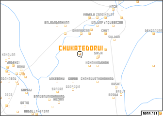
Chūkāt-e Dorū'ī (Sīstān va Balūchestān, Iran)Chūkāt-e Dorū'ī is a town in the Sīstān va Balūchestān region of Iran. An overview map of the region around Chūkāt-e Dorū'ī is displayed below.
regional and 3d topo map of Chūkāt-e Dorū'ī, Iran ::
Chūkāt-e Dorū'ī airports ::
The nearest airport is ZBR - Chah Bahar, located 97.5 km west of Chūkāt-e Dorū'ī.
Other airports nearby include GWD - Gwadar (108.8 km south east), TRB - Turbo Turbat Intl (175.0 km east), Nearby towns ::
Dād Allāh (2.5km south east) //
Ranjū (3.3km east) //
Sīrjā (3.6km east) //
Morīd (3.8km north east) //
Moḩammad Shāh (3.8km south east) //
‘Omar Bāzār (5.6km north) //
Dīn Moḩammad (5.3km east) //
Garāb (5.8km south) //
Shahīk Zehī (5.8km north) //
Bal-e Javādābād (6.5km north west) //
Chāh-e Dūst Moḩammad (6.5km south east) //
Shāh Bīgzī (6.8km north) //
Gār Faqīr (7.6km south) //
Dak-e Bāhū (7.5km south west) //
Chūt (7.5km north east) //
Bāl (8.1km north west) //
Daldap (8.1km north east) //
Sūldān (8.0km north east) //
Bal-e Dād Raḩmān (8.9km north west) //
Sangān (9.3km south west) //
Ya‘qūb Bāzār (10.0km north east) //
Basūt (9.9km south east) //
[all distances 'as the bird flies' and approximate] 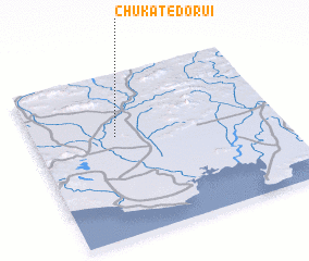 Places with similar names to Chūkāt-e Dorū'ī, Iran ::
// Chak Tātāru (BD)
// Chak Dedar (PK)
Disclaimer :: Information on this page comes without warranty of any kind |
||
|
Where is Chūkāt-e Dorū'ī? Elevation and coordinates ::
Latitude (lat): 25°37'0"N Longitude (lon): 61°20'0"E
Elevation (approx.): 29m (map arrows pan, magnifying glasses zoom) |
||
|
Visiting Chūkāt-e Dorū'ī? Hotel/Accommodation ::
Book a hotel in Chūkāt-e Dorū'ī Travel Guide ::
Buy a travel guide for Iran rental cars ::
car rental offers GPS waypoint ::
download a GPX waypoint (PoI) of Chūkāt-e Dorū'ī for your GPS receiver
|
||