|
search place name
|
||
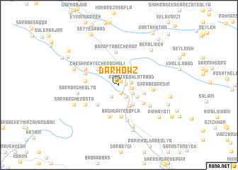
Dār Ḩowẕ (Lorestān, Iran)Dār Ḩowẕ is a town in the Lorestān region of Iran. An overview map of the region around Dār Ḩowẕ is displayed below.
regional and 3d topo map of Dār Ḩowẕ, Iran ::
Dār Ḩowẕ airports ::
The nearest airport is KSH - Bakhtaran Shahid Ashrafi Esfahani, located 130.8 km north west of Dār Ḩowẕ.
Other airports nearby include QMJ - Masjed Soleiman Shahid Asyaee (202.7 km south east), SDG - Sanandaj (214.2 km north west), Nearby towns ::
Kolah Jū (0.7km north east) //
Morīdābād (0.9km east) //
Cham Choghāl-e Soflá (1.3km south) //
Robāţ-e Dowlatābād (1.7km east) //
Pīr Jād (2.0km south west) //
Raḩmānābād (1.8km east) //
Cham Choghāl-e ‘Olyā (2.1km south east) //
Āb-e Shūr (2.2km south east) //
Zarrīn Choghā-ye ‘Olyā (2.8km north west) //
Zarrīnchoghā-ye Vosţá (2.8km north west) //
Zarrīn Choghā-ye Soflá (2.9km north west) //
Pelleh Havā (3.1km north east) //
Robāţ-e Namakī (3.0km south east) //
Z̄ahābī (3.2km north east) //
Tang-e Shabīkhūn (3.6km south) //
Tang-e Robāţ (3.6km south east) //
Dowlatābād (3.6km east) //
Cheshmeh-ye Cherāgh ‘Alī (3.8km north west) //
Shahrak-e Jadīd-e Zarrīn Choqā-ye Soflá (3.8km north west) //
Anjīrīsheh (4.2km south west) //
Khar Godāreh (4.3km south east) //
Bāgh Dā'ī-ye Soflá (4.9km south) //
Bāgh Dā'ī-ye ‘Olyā (5.1km south) //
Barāftāb-e Chenār (5.2km north) //
Ḩasanābād (4.4km west) //
Sarāb-e Bardīn (4.6km east) //
Tang-e Ḩasan (4.7km west) //
Qezeleh (5.6km south) //
Cheshmeh Şāleḩ (5.0km north west) //
[all distances 'as the bird flies' and approximate] 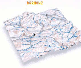 Places with similar names to Dār Ḩowẕ, Iran ::
Disclaimer :: Information on this page comes without warranty of any kind |
||
|
Where is Dār Ḩowẕ? Elevation and coordinates ::
Latitude (lat): 33°37'40"N Longitude (lon): 48°16'50"E
Elevation (approx.): 1336m (map arrows pan, magnifying glasses zoom) |
||
|
Visiting Dār Ḩowẕ? Hotel/Accommodation ::
Book a hotel in Dār Ḩowẕ Travel Guide ::
Buy a travel guide for Iran rental cars ::
car rental offers GPS waypoint ::
download a GPX waypoint (PoI) of Dār Ḩowẕ for your GPS receiver
|
||