|
search place name
|
||
Dārnīleh-ye Eskandar (Ostān-e Kermānshāh, Iran)Dārnīleh-ye Eskandar is a town in the Ostān-e Kermānshāh region of Iran. An overview map of the region around Dārnīleh-ye Eskandar is displayed below.
regional and 3d topo map of Dārnīleh-ye Eskandar, Iran ::

Dārnīleh-ye Eskandar airports ::
The nearest airport is SDG - Sanandaj, located 109.0 km north east of Dārnīleh-ye Eskandar.
Other airports nearby include KSH - Bakhtaran Shahid Ashrafi Esfahani (111.9 km east), Nearby towns ::
Kelāveh-ye Gārī (1.5km east) //
Kānī Karīm Yārvalī (1.9km north) //
Dārlārad (2.5km north) //
Kelāsh Tarkar (3.0km east) //
Dengī-ye ‘Alībag (5.6km south) //
Meyvakah (4.9km east) //
Ghūl-e Rash (4.9km east) //
Kānī Sheykh (4.9km east) //
Bānzardbān Āvāreh (6.3km south west) //
Dengī-ye ‘Abbās Dāreh Zard (7.4km south) //
Tal Khalvatī-ye Qāder Raḩmān (7.6km south) //
Deh Sefīd (8.0km south) //
Javānmīrī (8.7km north west) //
Kafrū Salmān (8.7km south west) //
Kafrū Bābākīyeh-e Şayyādī (8.7km south west) //
Anjīrebān Āvāreh (8.8km south west) //
Mollāchīyeh (9.1km south east) //
Kadkhodā Ḩoseyn (9.8km south east) //
Sarzal (9.6km south west) //
[all distances 'as the bird flies' and approximate] 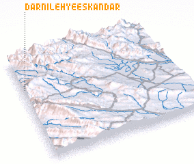 Places with similar names to Dārnīleh-ye Eskandar, Iran :: Disclaimer :: Information on this page comes without warranty of any kind |
||
|
Where is Dārnīleh-ye Eskandar? Elevation and coordinates ::
Latitude (lat): 34°42'0"N Longitude (lon): 46°1'0"E
Elevation (approx.): 838m (map arrows pan, magnifying glasses zoom) |
||
|
Visiting Dārnīleh-ye Eskandar? Hotel/Accommodation ::
Book a hotel in Dārnīleh-ye Eskandar Travel Guide ::
Buy a travel guide for Iran rental cars ::
car rental offers GPS waypoint ::
download a GPX waypoint (PoI) of Dārnīleh-ye Eskandar for your GPS receiver
|
||