|
search place name
|
||
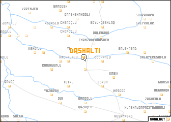
Dāsh Āltī (Iran)Dāsh Āltī is a town in Iran. An overview map of the region around Dāsh Āltī is displayed below.
regional and 3d topo map of Dāsh Āltī, Iran ::
Dāsh Āltī airports ::
The nearest airport is SDG - Sanandaj, located 145.2 km south west of Dāsh Āltī.
Other airports nearby include RAS - Rasht (187.4 km north east), KSH - Bakhtaran Shahid Ashrafi Esfahani (210.9 km south west), Nearby towns ::
Shūrjā (1.9km south) //
Yār Aḩmadlū (2.4km north west) //
Dāshāltū (2.4km north west) //
Kachal Ālū (3.0km west) //
Doghānlū (3.0km east) //
Emāmzādeh Hāshem (4.0km north) //
Gūjeh Lūgeh (4.5km west) //
Qal‘eh Jūq (5.9km north east) //
Tetāl (6.3km south west) //
Chopoqlū (6.3km north west) //
Borūn (6.3km south east) //
Kasīk (6.2km south east) //
Kīneh Dūrlū (6.3km west) //
Chepoqlū (8.0km north) //
Boyūk Qeshlāq (8.0km north) //
Yūz Bāshī (9.5km south west) //
Gomeshlū (9.5km north west) //
‘Abbāslū (9.5km north west) //
Mesgar (9.5km south east) //
[all distances 'as the bird flies' and approximate] 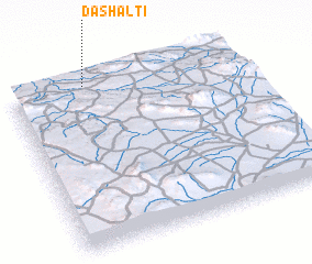 Places with similar names to Dāsh Āltī, Iran ::
Disclaimer :: Information on this page comes without warranty of any kind |
||
|
Where is Dāsh Āltī? Elevation and coordinates ::
Latitude (lat): 35°59'0"N Longitude (lon): 48°20'0"E
Elevation (approx.): 1603m (map arrows pan, magnifying glasses zoom) |
||
|
Visiting Dāsh Āltī? Hotel/Accommodation ::
Book a hotel in Dāsh Āltī Travel Guide ::
Buy a travel guide for Iran rental cars ::
car rental offers GPS waypoint ::
download a GPX waypoint (PoI) of Dāsh Āltī for your GPS receiver
|
||