|
search place name
|
||
Dashtkār (Kermān, Iran)Dashtkār is a town in the Kermān region of Iran. An overview map of the region around Dashtkār is displayed below.
regional and 3d topo map of Dashtkār, Iran ::

Dashtkār airports ::
The nearest airport is KER - Kerman, located 49.3 km north east of Dashtkār.
Nearby towns ::
Ḩeydarābād (0.9km north east) //
Tolombeh-ye Z̄āferī (0.9km south) //
Jalālābād (1.6km north west) //
Ne‘matābād (2.0km north east) //
Tolombeh-ye Asadābād (2.0km east) //
Tolombeh-ye Doktor Khāleqī (3.0km south west) //
Nāşerābād (3.5km north west) //
Tolombeh-ye Kalāntārī (4.1km south west) //
Mobārakeh (3.8km north west) //
Tolombeh-ye Moḩammad Khān (4.6km south) //
Deh Now (4.1km west) //
Tolombeh-ye ‘Alīābād (4.4km south east) //
Bahādābād (4.3km west) //
Tolombeh-ye Malek Manşūr (5.4km south west) //
Āteshān (5.0km north west) //
Sharīfābād (5.5km north west) //
Tolombeh-ye Najafābād (6.1km south) //
Tolombeh-ye Moḩammad ‘Alī-ye Rashīd Farrokhī (6.5km south) //
Tolombeh-ye Sherkatābād (6.1km south east) //
‘Alīābād (6.2km west) //
Jalālābād (6.3km west) //
Tolombeh-ye ‘Abdollāhābād (6.8km east) //
Ḩanafīyeh (7.1km west) //
Tolombeh-ye Deh Bābak (8.3km south) //
[all distances 'as the bird flies' and approximate] 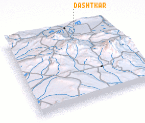 Places with similar names to Dashtkār, Iran ::
// Dasht-e Gūr (IR)
// Dasht-e Kowr (IR)
// Dasht-e Kūr (IR)
// Dasht-e Qīr (IR)
// Dasht-e Qūrī (IR)
Disclaimer :: Information on this page comes without warranty of any kind |
||
|
Where is Dashtkār? Elevation and coordinates ::
Latitude (lat): 29°54'25"N Longitude (lon): 56°39'50"E
Elevation (approx.): 2072m (map arrows pan, magnifying glasses zoom) |
||
|
Visiting Dashtkār? Hotel/Accommodation ::
Book a hotel in Dashtkār Travel Guide ::
Buy a travel guide for Iran rental cars ::
car rental offers GPS waypoint ::
download a GPX waypoint (PoI) of Dashtkār for your GPS receiver
|
||