|
search place name
|
||
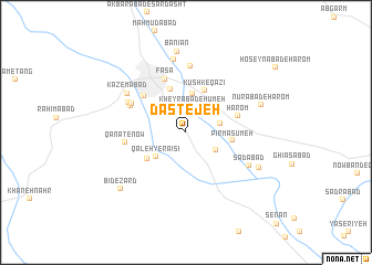
Dastejeh (Fārs, Iran)Dastejeh is a town in the Fārs region of Iran. An overview map of the region around Dastejeh is displayed below.
regional and 3d topo map of Dastejeh, Iran ::
Dastejeh airports ::
The nearest airport is SYZ - Shiraz Shahid Dastghaib Intl, located 127.2 km north west of Dastejeh.
Nearby towns ::
Kheyrābād-e Ḩūmeh (2.6km north) //
Şaḩrā Rūd (3.2km south east) //
Shastekān (3.2km east) //
Qal‘eh-ye Ra'īsī (3.7km south west) //
Dasht-e Ahmad (3.9km north) //
Kūshk-e Qāzī (4.5km north) //
Ādmard (4.6km north) //
Şoḩbatū (4.4km south west) //
Pīr Ma‘şūmeh (4.2km east) //
Hārom (4.9km east) //
Fīrūz (5.3km north west) //
Fasā (5.7km north) //
Chakat (5.5km north west) //
Şoghād (5.6km north west) //
Qanāt-e Now (5.5km west) //
Moqd (5.9km north west) //
Kahnekūyeh (6.7km north) //
Kāz̧emābād (6.5km north west) //
Sa‘dābād (6.5km south east) //
Kūshk-e Bānīān (7.4km north) //
Nūrābād-e Hārom (7.2km north east) //
Moḩammadābād (7.4km south east) //
Bānīān (8.2km north) //
Bīd-e Zard (8.1km south west) //
[all distances 'as the bird flies' and approximate]  Places with similar names to Dastejeh, Iran ::
Disclaimer :: Information on this page comes without warranty of any kind |
||
|
Where is Dastejeh? Elevation and coordinates ::
Latitude (lat): 28°53'27"N Longitude (lon): 53°40'8"E
Elevation (approx.): 1328m (map arrows pan, magnifying glasses zoom) |
||
|
Visiting Dastejeh? Hotel/Accommodation ::
Book a hotel in Dastejeh Travel Guide ::
Buy a travel guide for Iran rental cars ::
car rental offers GPS waypoint ::
download a GPX waypoint (PoI) of Dastejeh for your GPS receiver
|
||