|
search place name
|
||
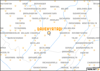
Daveh Yātāqī (Ostān-e Āz̄arbāyjān-e Sharqī, Iran)Daveh Yātāqī is a town in the Ostān-e Āz̄arbāyjān-e Sharqī region of Iran. An overview map of the region around Daveh Yātāqī is displayed below.
regional and 3d topo map of Daveh Yātāqī, Iran ::
Daveh Yātāqī airports ::
The nearest airport is TBZ - Tabriz Intl, located 121.4 km north west of Daveh Yātāqī.
Other airports nearby include SDG - Sanandaj (215.1 km south), Nearby towns ::
Qomeshlū (1.5km west) //
Takānlū-ye ‘Olyā (2.4km north west) //
Khalaj (3.5km north east) //
Īshlaq Kandī (4.0km south) //
Īmeshjeh (5.1km north) //
Sūghānchī (4.4km east) //
Chūgānlū (4.4km west) //
Īdahlū (4.8km south west) //
Jārchī Kandī Kūh (4.8km north west) //
Qezelābād (5.8km south) //
Qezeljeh (5.8km south west) //
Takānlū-ye Soflá (6.3km north west) //
Moşţafá Kandī (6.3km south west) //
Daveh Meydānī (7.4km north) //
Golī Bolāgh (6.2km east) //
Qūchī Kandī (7.1km north east) //
Kord Kandī (7.1km south west) //
Qezel Qayah (8.0km south) //
Gerd Ālū (8.1km south east) //
Beyg Kandī (8.1km north west) //
Qareh Āghāj (8.8km south east) //
Dabardān-e Soflá (9.5km south east) //
Qarājeh Qayah (9.5km north west) //
[all distances 'as the bird flies' and approximate]  Places with similar names to Daveh Yātāqī, Iran ::
// Devyatki (UA)
// Devyatka (RU)
// Devyatka (RU)
// Davah Yātāqī (IR)
// Devyatka (KZ)
// (( Devyatka )) (RU)
// Devyatki (BY)
Disclaimer :: Information on this page comes without warranty of any kind |
||
|
Where is Daveh Yātāqī? Elevation and coordinates ::
Latitude (lat): 37°11'0"N Longitude (lon): 46°55'0"E
Elevation (approx.): 1964m (map arrows pan, magnifying glasses zoom) |
||
|
Visiting Daveh Yātāqī? Hotel/Accommodation ::
Book a hotel in Daveh Yātāqī Travel Guide ::
Buy a travel guide for Iran rental cars ::
car rental offers GPS waypoint ::
download a GPX waypoint (PoI) of Daveh Yātāqī for your GPS receiver
|
||