|
search place name
|
||
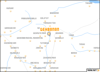
Deh Banān (Iran)Deh Banān is a town in Iran. An overview map of the region around Deh Banān is displayed below.
regional and 3d topo map of Deh Banān, Iran ::
Deh Banān airports ::
The nearest airport is KER - Kerman, located 104.4 km south of Deh Banān.
Nearby towns ::
Gechīl-e Bālā (1.6km west) //
Korīkū'īyeh-ye Pā'īn (1.9km south) //
Deh-e Ḩasan-e Kalmoḩammad (1.9km south) //
Begeshtū (1.9km north) //
Sorkh Bīd-e Pā'īn (2.4km north west) //
Sorkh Bīd-e Bālā (2.4km north west) //
Bīdū (2.4km south east) //
Dehnū-ye Pā'īn (3.2km west) //
Korīkū'īyeh-e Bālā (3.2km west) //
Mowrūs̄ī (3.7km north) //
Tah Sūkhteh (3.7km north) //
Deh Mamī (3.2km east) //
Tūt-e Bīdū (4.0km south west) //
Deh Bālā (3.7km south east) //
Gowdū (4.9km south west) //
Gol-e Tūt (5.8km north) //
Zārchū (6.4km south west) //
Deh-e ‘Abbās-e Kalmoḩammad (6.6km west) //
Bīdgarām (7.6km north) //
Tīrān (7.1km east) //
Dar-e Kerū (8.4km north west) //
Dar-e Zangalān (8.4km north west) //
Darkarū (8.4km north west) //
Pābīdnān-e Bālā (8.6km north west) //
[all distances 'as the bird flies' and approximate] 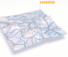 Places with similar names to Deh Banān, Iran ::
Disclaimer :: Information on this page comes without warranty of any kind |
||
|
Where is Deh Banān? Elevation and coordinates ::
Latitude (lat): 31°9'0"N Longitude (lon): 56°33'0"E
Elevation (approx.): 2414m (map arrows pan, magnifying glasses zoom) |
||
|
Visiting Deh Banān? Hotel/Accommodation ::
Book a hotel in Deh Banān Travel Guide ::
Buy a travel guide for Iran rental cars ::
car rental offers GPS waypoint ::
download a GPX waypoint (PoI) of Deh Banān for your GPS receiver
|
||