|
search place name
|
||
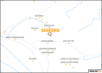
Deh-e Sa‘īd (Kermān, Iran)Deh-e Sa‘īd is a town in the Kermān region of Iran. An overview map of the region around Deh-e Sa‘īd is displayed below.
regional and 3d topo map of Deh-e Sa‘īd, Iran ::
Deh-e Sa‘īd airports ::
The nearest airport is KER - Kerman, located 33.0 km west of Deh-e Sa‘īd.
Nearby towns ::
Deh Fārsī (1.4km north west) //
Dāneshābād (2.7km south west) //
Rostamābād (3.1km north) //
Deh-e Ẕeyā'ī (3.3km north) //
Bīkand Dahaneh-ye Ḩoseynābād (5.3km south) //
Dow Rāh-e Shahdād (5.3km south) //
Ḩoseynābād-e Pashtan (5.3km north) //
Gojgīn (5.6km north west) //
Bīkand Amīnū (6.7km south) //
Kūh Joftān (6.2km south east) //
Gīnegān (6.9km north west) //
Bondar-e Vālīābād (6.9km north west) //
Deh Bālā (7.7km north west) //
Ḩoseynābād-e Torābīhā (7.9km north west) //
Allāhābād (9.4km north west) //
[all distances 'as the bird flies' and approximate]  Places with similar names to Deh-e Sa‘īd, Iran ::
// Tahaouast (MA)
// Tahoe City (US)
// Ţoheşti (RO)
// Deh-e Āzād (IR)
// Deh-e Ezdī (IR)
// Dhista (BD)
// Tauhá see Tauá (BR)
// Deh-e Seyyed (IR)
Disclaimer :: Information on this page comes without warranty of any kind |
||
|
Where is Deh-e Sa‘īd? Elevation and coordinates ::
Latitude (lat): 30°15'50"N Longitude (lon): 57°17'37"E
Elevation (approx.): 2226m (map arrows pan, magnifying glasses zoom) |
||
|
Visiting Deh-e Sa‘īd? Hotel/Accommodation ::
Book a hotel in Deh-e Sa‘īd Travel Guide ::
Buy a travel guide for Iran rental cars ::
car rental offers GPS waypoint ::
download a GPX waypoint (PoI) of Deh-e Sa‘īd for your GPS receiver
|
||