|
search place name
|
||
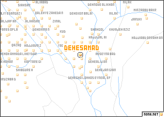
Deh-e Şamad (Sīstān va Balūchestān, Iran)Deh-e Şamad is a town in the Sīstān va Balūchestān region of Iran. An overview map of the region around Deh-e Şamad is displayed below.
regional and 3d topo map of Deh-e Şamad, Iran ::
Deh-e Şamad airports ::
The nearest airport is ZAH - Zahedan Intl, located 175.9 km south west of Deh-e Şamad.
Nearby towns ::
Deh Now (0.0km north) //
Nāder ‘Elm (1.9km south) //
Allāh Dow (1.9km south) //
Deh-e Ghafūr (1.6km east) //
Deh-e Nūr Moḩammad-e Nārū'ī (1.6km east) //
‘Abd ol ‘Azīz (1.6km west) //
Khvājeh Aḩmad (2.2km south) //
Jey Sorkh (2.4km south west) //
Lāl Khān (2.4km south west) //
Sīāh Khān (2.4km south west) //
Balūch Khān (2.4km north west) //
Lajeh'ī (2.4km north east) //
Deh-e Bacheh Dor (2.4km north east) //
Āzād (2.4km north east) //
Shāh Karam (3.3km north east) //
Leylām (3.5km south east) //
Deh-e ‘Alī Khān (3.7km south) //
Shahrestān-e Aḩmad ‘Alī Khān (3.2km west) //
Moḩammad-e Shāh Karam (3.7km north) //
Sharīfābād (3.7km north) //
Deh-e ‘Asgarī (3.7km north) //
Deh-e ‘Alī Jān (3.7km south east) //
Mollā Sharīf (3.7km south east) //
Deh-e Mohājerī (3.7km south east) //
Khalīfeh-ye Kachūl (3.7km south east) //
‘Abd ol Majīd (3.7km north east) //
Yādegār (3.7km north west) //
Allāh Dād (3.7km north east) //
Deh-e Āzād (3.7km north west) //
[all distances 'as the bird flies' and approximate] 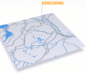 Places with similar names to Deh-e Şamad, Iran :: Disclaimer :: Information on this page comes without warranty of any kind |
||
|
Where is Deh-e Şamad? Elevation and coordinates ::
Latitude (lat): 30°53'0"N Longitude (lon): 61°45'0"E
Elevation (approx.): 493m (map arrows pan, magnifying glasses zoom) |
||
|
Visiting Deh-e Şamad? Hotel/Accommodation ::
Book a hotel in Deh-e Şamad Travel Guide ::
Buy a travel guide for Iran rental cars ::
car rental offers GPS waypoint ::
download a GPX waypoint (PoI) of Deh-e Şamad for your GPS receiver
|
||