|
search place name
|
||
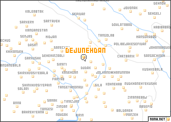
Dejūnehdān (Fārs, Iran)Dejūnehdān is a town in the Fārs region of Iran. An overview map of the region around Dejūnehdān is displayed below.
regional and 3d topo map of Dejūnehdān, Iran ::
Dejūnehdān airports ::
The nearest airport is SYZ - Shiraz Shahid Dastghaib Intl, located 159.1 km south east of Dejūnehdān.
Other airports nearby include BUZ - Bushehr (181.8 km south), Nearby towns ::
Nargesī (1.1km east) //
Dūdak (2.4km south) //
Rejūneh Dān (2.5km south east) //
Gūvan (3.2km north) //
Kūh-e Qal‘eh Ţūs (3.0km south west) //
Tūmanak-e Bālā (3.4km south) //
Rūdkhāneh-ye Esrī (3.4km east) //
Tang-e Esrī (3.7km north east) //
Chel Kareh (4.0km south east) //
Delī (4.0km south east) //
Cheshmeh Gol (4.1km north) //
Barqolong (4.2km south) //
Tūmanak-e Pā'īn (4.1km south west) //
Kāsehgān (4.5km south west) //
Dūdek-e Bālā (4.5km south west) //
Dūdek-e Pā'īn (4.5km south west) //
Seyyed Ḩasan (4.5km south west) //
Tūp Āb (5.3km south) //
Kūtāk (5.1km north east) //
Jolkareh (4.9km south east) //
Mollā-ye Sefīd (4.8km west) //
Sīratī (4.8km west) //
Kal-e Esrī (5.1km north east) //
Kūn Sorkh (4.9km east) //
Sar-e Chāh (4.9km north west) //
Mīr Moḩammad Zekī (5.6km south) //
Qal‘eh-ye Mūrd (5.7km south west) //
Tangolāb (6.2km north east) //
Nesah-ye Mollā Ghaz̧anfar (6.2km south east) //
[all distances 'as the bird flies' and approximate] 
Disclaimer :: Information on this page comes without warranty of any kind |
||
|
Where is Dejūnehdān? Elevation and coordinates ::
Latitude (lat): 30°30'52"N Longitude (lon): 51°22'48"E
Elevation (approx.): 1599m (map arrows pan, magnifying glasses zoom) |
||
|
Visiting Dejūnehdān? Hotel/Accommodation ::
Book a hotel in Dejūnehdān Travel Guide ::
Buy a travel guide for Iran rental cars ::
car rental offers GPS waypoint ::
download a GPX waypoint (PoI) of Dejūnehdān for your GPS receiver
|
||