|
search place name
|
||
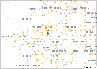
Dey (Sīstān va Balūchestān, Iran)Dey is a town in the Sīstān va Balūchestān region of Iran. An overview map of the region around Dey is displayed below.
regional and 3d topo map of Dey, Iran ::
Dey airports ::
The nearest airport is ZAH - Zahedan Intl, located 170.5 km south of Dey.
Nearby towns ::
Deh Boland (0.3km south) //
Deh Sheykh (0.6km north) //
Zeyārat (0.6km west) //
Deh-e Ebrāhīm Mūsá (1.2km north east) //
Deh-e Ḩoseyn Zeynal (1.3km south east) //
Sīāh Sar (1.3km north east) //
Sadīf (1.8km north) //
Deh-e Karamī (2.0km south) //
Deh-e Gol Moḩammad-e Bālā (2.0km north east) //
Dādallāh (2.3km south east) //
Kalāt-e Sālārī (2.4km north) //
Deh-e Akbar ‘Abbās (2.1km west) //
Deh-e Madadkhān (2.5km north) //
Deh-e Ḩāj Gol Mīr (2.3km west) //
Neygerd (2.8km north) //
Şayyādān-e Pā'īn (2.7km west) //
Deh-e Esmā‘īl Qanbar (2.9km south west) //
Deh-e Shadar (3.5km north) //
Deh-e Shāh Naz̧ar (3.1km north east) //
Deh Shīb (3.1km north east) //
Teymūrābād (3.2km south west) //
Deh-e Ḩoseyn-e ‘Alī Akbar (3.3km south east) //
Khāneh-ye Mīr ‘Abbās (3.7km north) //
Shahdād (3.7km north) //
Mīrābād (3.7km north) //
Deh Kūl (3.5km north east) //
Dādī (3.5km north west) //
‘Avaẕ-e Pā'īn (4.0km south) //
Deh-e Ḩāj Moḩammad-e Balūch (4.1km north west) //
[all distances 'as the bird flies' and approximate]  Places with similar names to Dey, Iran ::
Disclaimer :: Information on this page comes without warranty of any kind |
||
|
Where is Dey? Elevation and coordinates ::
Latitude (lat): 30°57'5"N Longitude (lon): 61°24'21"E
Elevation (approx.): 480m (map arrows pan, magnifying glasses zoom) |
||
|
Visiting Dey? Hotel/Accommodation ::
Book a hotel in Dey Travel Guide ::
Buy a travel guide for Iran rental cars ::
car rental offers GPS waypoint ::
download a GPX waypoint (PoI) of Dey for your GPS receiver
|
||