|
search place name
|
||
Dīzaj-e Talkhāj (Ostān-e Āz̄arbāyjān-e Sharqī, Iran)Dīzaj-e Talkhāj is a town in the Ostān-e Āz̄arbāyjān-e Sharqī region of Iran. An overview map of the region around Dīzaj-e Talkhāj is displayed below.
regional and 3d topo map of Dīzaj-e Talkhāj, Iran ::

Dīzaj-e Talkhāj airports ::
The nearest airport is TBZ - Tabriz Intl, located 79.3 km south west of Dīzaj-e Talkhāj.
Nearby towns ::
Kordlar (0.7km south east) //
Dehestān (1.5km north) //
Kafāleq (1.8km north west) //
Mordeh Katān (2.4km north east) //
Karamgāh (2.4km north east) //
‘Alīābād (2.4km south east) //
Kalhor (3.1km south west) //
Chāqāleh (3.7km south west) //
Qūrchī Kandī (4.0km south) //
Chalfīr (3.8km west) //
Zargar (4.4km east) //
Zarrīn (4.7km south east) //
Tāzeh Kand (4.8km east) //
Īlkadeh (6.3km south west) //
Ahar (6.6km north) //
Dīzbīn (5.7km north west) //
Khownyaq (5.4km west) //
Gūrehtī (5.4km west) //
Razīn (5.8km east) //
Sholehborān (7.6km north) //
Dāshlūjeh (6.1km east) //
Cheshmeh Vazān (6.1km west) //
Dīzaj-e Jālū (7.1km north east) //
Jāleq (6.5km east) //
Shīlīleh (8.2km north) //
Ālmān-e Qadīm (6.9km south east) //
Kord Aḩmad-e Soflá (8.2km north west) //
[all distances 'as the bird flies' and approximate] 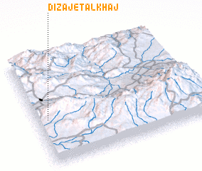 Places with similar names to Dīzaj-e Talkhāj, Iran :: Disclaimer :: Information on this page comes without warranty of any kind |
||
|
Where is Dīzaj-e Talkhāj? Elevation and coordinates ::
Latitude (lat): 38°25'0"N Longitude (lon): 47°4'0"E
Elevation (approx.): 1498m (map arrows pan, magnifying glasses zoom) |
||
|
Visiting Dīzaj-e Talkhāj? Hotel/Accommodation ::
Book a hotel in Dīzaj-e Talkhāj Travel Guide ::
Buy a travel guide for Iran rental cars ::
car rental offers GPS waypoint ::
download a GPX waypoint (PoI) of Dīzaj-e Talkhāj for your GPS receiver
|
||