|
search place name
|
||
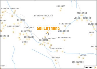
Dowlatābād (Kermān, Iran)Dowlatābād is a town in the Kermān region of Iran. An overview map of the region around Dowlatābād is displayed below.
regional and 3d topo map of Dowlatābād, Iran ::
Dowlatābād airports ::
The nearest airport is KER - Kerman, located 137.5 km north west of Dowlatābād.
Other airports nearby include BND - Bandar Abbass Intl (243.0 km south west), Nearby towns ::
Zārchūʼīyeh (1.5km south west) //
Gulaz Chunu (1.9km north) //
Chekor Chaman (2.4km south) //
Bāb Gorg (3.5km south) //
Bāb Mārān (3.5km south west) //
Bāb Bīdān (4.2km south) //
Bāb Şafḩeh (4.2km south west) //
Şāḩebābād (4.3km south) //
Sangdān (4.9km south) //
Seyfābād (4.8km south west) //
Gharīb Shāh (5.1km east) //
Sang Nevesht (5.8km east) //
Khāneh-ye Marghzār (6.6km north) //
Darreh-ye Gorkī (6.9km south east) //
Deh-e Nowrūz (6.5km north east) //
Omrūdū'yeh (6.7km west) //
Mehdīābād (6.7km west) //
Noşratābād (7.2km west) //
Khūkestān (7.4km west) //
Kahn-e Kamūn (8.2km south east) //
Malekābād (7.6km west) //
[all distances 'as the bird flies' and approximate]  Places with similar names to Dowlatābād, Iran ::
// Dowlatābād (IR)
// Dowlatābād (IR)
// Dowlatābād (IR)
// Dowlatābād (IR)
// Dowlatābād (IR)
// Dowlatābād (IR)
// Dowlatābād (IR)
// Dowlatābād (IR)
// Dowlatābād (IR)
// Dowlatābād (IR)
Disclaimer :: Information on this page comes without warranty of any kind |
||
|
Where is Dowlatābād? Elevation and coordinates ::
Latitude (lat): 29°9'0"N Longitude (lon): 57°33'0"E
Elevation (approx.): 3030m (map arrows pan, magnifying glasses zoom) |
||
|
Visiting Dowlatābād? Hotel/Accommodation ::
Book a hotel in Dowlatābād Travel Guide ::
Buy a travel guide for Iran rental cars ::
car rental offers GPS waypoint ::
download a GPX waypoint (PoI) of Dowlatābād for your GPS receiver
|
||