|
search place name
|
||
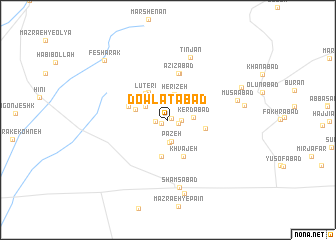
Dowlatābād (Eşfahān, Iran)Dowlatābād is a town in the Eşfahān region of Iran. An overview map of the region around Dowlatābād is displayed below.
regional and 3d topo map of Dowlatābād, Iran ::
Dowlatābād airports ::
The nearest airport is AZD - Yazd Shahid Sadooghi, located 200.0 km south east of Dowlatābād.
Nearby towns ::
Mandābād (0.4km north east) //
Mīr Homāyūn (0.7km south west) //
Homāgerān (1.0km east) //
Ḩoseynābād (1.2km west) //
Hashemābād (1.2km east) //
Sesnābād (2.0km north) //
Pāzeh (2.4km south) //
Kebrītchī (2.5km south) //
Kerdābād (2.4km east) //
Herīzeh (2.9km north) //
Barātī (2.6km north west) //
Kohrān (2.6km north west) //
Lūderīcheh (3.5km north west) //
Ḩojjatābād (3.3km west) //
Lūterī (3.6km north west) //
Gezanābād (3.5km north west) //
Jabal (4.1km south) //
Ābkhārak (3.6km east) //
Khvājeh (4.3km south) //
Shamsābād (4.0km west) //
‘Azīzābād (5.3km north) //
Ḩeydarābād (5.3km north) //
Tīnjān (7.3km north) //
Shamsābād (7.6km south) //
Mūsáābād (6.9km east) //
Kūhpāyeh (8.4km south) //
Ḩojjatābād (7.4km east) //
Kīchī (7.8km north east) //
Feshārak (8.9km north west) //
[all distances 'as the bird flies' and approximate] 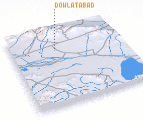 Places with similar names to Dowlatābād, Iran ::
// Dowlatābād (IR)
// Dowlatābād (IR)
// Dowlatābād (IR)
// Dowlatābād (IR)
// Dowlatābād (IR)
// Dowlatābād (IR)
// Dowlatābād (IR)
// Dowlatābād (IR)
// Dowlatābād (IR)
// Dowlatābād (IR)
Disclaimer :: Information on this page comes without warranty of any kind |
||
|
Where is Dowlatābād? Elevation and coordinates ::
Latitude (lat): 32°47'12"N Longitude (lon): 52°25'23"E
Elevation (approx.): 1989m (map arrows pan, magnifying glasses zoom) |
||
|
Visiting Dowlatābād? Hotel/Accommodation ::
Book a hotel in Dowlatābād Travel Guide ::
Buy a travel guide for Iran rental cars ::
car rental offers GPS waypoint ::
download a GPX waypoint (PoI) of Dowlatābād for your GPS receiver
|
||