|
search place name
|
||
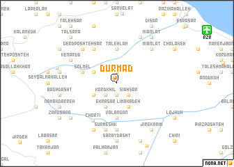
Dūrmad (Iran)Dūrmad is a town in Iran. An overview map of the region around Dūrmad is displayed below.
regional and 3d topo map of Dūrmad, Iran ::
Dūrmad airports ::
The nearest airport is RZR - Ramsar, located 14.3 km north east of Dūrmad.
Other airports nearby include RAS - Rasht (100.1 km north west), THR - Teheran Mehrabad Intl (144.3 km south east), Nearby towns ::
Īzkī (1.9km south) //
Sūteh (1.9km north) //
Kord Khīl (2.4km south west) //
Sīāhsar (2.4km south east) //
Karīkesh (3.5km south west) //
Pā'īn Bāzū (3.5km north west) //
Ekrā Sar (4.0km south) //
Līmākadeh (4.0km south) //
Valangān (5.6km south) //
Ţāleh Lam (5.6km north) //
Solmel (4.8km north west) //
Sūleh Sarā (6.3km north west) //
Chortī (6.7km south west) //
Hezār Lāt (7.4km south) //
Sūrmeshk (7.6km south) //
Gerd Poshtehsar (7.1km north west) //
Mīān Lāt (7.1km north east) //
Jīr Rūd (8.0km south) //
Ardam Bon (8.0km north) //
Kenārūd (7.0km north west) //
Jīr-e Karīm (8.6km south east) //
Mehrān (8.1km south west) //
Mīān Lāt (8.6km north east) //
Ţāl Sarā (9.5km north west) //
[all distances 'as the bird flies' and approximate] 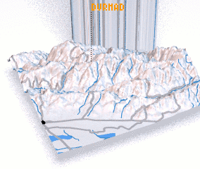 Places with similar names to Dūrmad, Iran ::
Disclaimer :: Information on this page comes without warranty of any kind |
||
|
Where is Dūrmad? Elevation and coordinates ::
Latitude (lat): 36°50'0"N Longitude (lon): 50°33'0"E
Elevation (approx.): 1572m (map arrows pan, magnifying glasses zoom) |
||
|
Visiting Dūrmad? Hotel/Accommodation ::
Book a hotel in Dūrmad Travel Guide ::
Buy a travel guide for Iran rental cars ::
car rental offers GPS waypoint ::
download a GPX waypoint (PoI) of Dūrmad for your GPS receiver
|
||