|
search place name
|
||
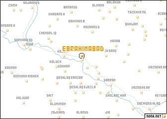
Ebrāhīmābād (Iran)Ebrāhīmābād is a town in Iran. An overview map of the region around Ebrāhīmābād is displayed below.
regional and 3d topo map of Ebrāhīmābād, Iran ::
Ebrāhīmābād airports ::
The nearest airport is RAS - Rasht, located 81.9 km east of Ebrāhīmābād.
Other airports nearby include RZR - Ramsar (172.5 km east), SDG - Sanandaj (254.2 km south west), Nearby towns ::
Qeshlāq Pīsak (0.2km west) //
Qeshlāq-e Banārūd (1.9km south) //
Mīrzā Khānlū (2.8km south east) //
Kolū'īm (3.6km west) //
Darrām (4.1km south east) //
Gowhar (4.2km south west) //
Sorkheh Sang (4.1km east) //
Anz̄ar (5.3km south) //
Jezlān Dasht (5.0km south east) //
Chavarzaq (5.8km south east) //
Qeshlāq-e Anz̄ar (5.8km south west) //
Kolūch (5.1km west) //
Pāvah Rūd (6.4km north) //
Qeshlāq-e Jezlā (7.4km south) //
Gāvkhosb (7.6km north) //
Jezlā (7.6km south) //
Vanāb (6.6km north east) //
Kolūchābād (7.2km south west) //
Chavarzaq (8.0km south) //
Qeshlāq-e Banārūd (7.1km north west) //
Darrām (7.6km south east) //
Chenārlīq (7.9km north west) //
Pīāmīn (8.6km south east) //
Qeshlāq-e Khasāreh (9.7km north west) //
[all distances 'as the bird flies' and approximate] 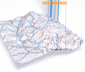 Places with similar names to Ebrāhīmābād, Iran ::
// Ebrahīmābād (IR)
// Ebrāhīmābād (IR)
// Ebrāhīmābād (IR)
// Ebrāhīmābād (IR)
// Ebrāhīmābād (IR)
// Ebrāhīmābād (IR)
// Ebrāhīmābād (IR)
// Ebrāhīmābād (IR)
// Ebrāhīmābād (IR)
// Ebrāhīmābād (IR)
Disclaimer :: Information on this page comes without warranty of any kind |
||
|
Where is Ebrāhīmābād? Elevation and coordinates ::
Latitude (lat): 37°3'0"N Longitude (lon): 48°45'0"E
Elevation (approx.): 509m (map arrows pan, magnifying glasses zoom) |
||
|
Visiting Ebrāhīmābād? Hotel/Accommodation ::
Book a hotel in Ebrāhīmābād Travel Guide ::
Buy a travel guide for Iran rental cars ::
car rental offers GPS waypoint ::
download a GPX waypoint (PoI) of Ebrāhīmābād for your GPS receiver
|
||