|
search place name
|
||
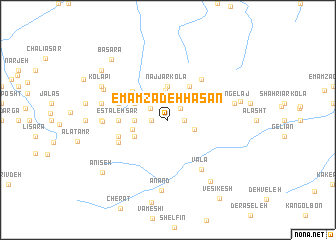
Emāmzādeh Ḩasan (Iran)Emāmzādeh Ḩasan is a town in Iran. An overview map of the region around Emāmzādeh Ḩasan is displayed below.
regional and 3d topo map of Emāmzādeh Ḩasan, Iran ::
Emāmzādeh Ḩasan airports ::
The nearest airport is THR - Teheran Mehrabad Intl, located 134.9 km west of Emāmzādeh Ḩasan.
Nearby towns ::
Pīr Golūm (1.5km west) //
Astchāl (1.5km west) //
Astal Sar (1.5km east) //
Deh Sar (1.7km north east) //
Ang Rīzān (2.0km north west) //
Savād-e Rūd Bār (2.6km south east) //
Sefīd Rīz (3.3km north) //
Rangrīzān (3.0km west) //
Najjār Kolā (3.7km north) //
Sang Lapā (3.4km west) //
Halīān (3.5km north west) //
Asbakhānī (3.5km south west) //
Sefīd Kolā (4.2km north east) //
Galīrān (4.5km north west) //
Estaleh Sar (4.5km west) //
Gardaneh Sar (5.4km north east) //
Marganeh (4.9km west) //
Shāshpazūn (4.9km west) //
Karlī Bon (5.1km south west) //
Valā (6.3km south east) //
Karī Yūsh (5.9km west) //
Garīvash (6.0km west) //
Talleh (6.3km west) //
Nateh (6.3km west) //
Sangelaj (6.3km east) //
Anand (7.9km south) //
Damīlarz (6.8km north west) //
Kolāpī (7.0km north west) //
Oţāqsī (7.0km north west) //
[all distances 'as the bird flies' and approximate]  Places with similar names to Emāmzādeh Ḩasan, Iran ::
// Emāmzādeh Ḩasan (IR)
// Emāmzādeh Ḩasan (IR)
Disclaimer :: Information on this page comes without warranty of any kind |
||
|
Where is Emāmzādeh Ḩasan? Elevation and coordinates ::
Latitude (lat): 36°4'0"N Longitude (lon): 52°44'0"E
Elevation (approx.): 2645m (map arrows pan, magnifying glasses zoom) |
||
|
Visiting Emāmzādeh Ḩasan? Hotel/Accommodation ::
Book a hotel in Emāmzādeh Ḩasan Travel Guide ::
Buy a travel guide for Iran rental cars ::
car rental offers GPS waypoint ::
download a GPX waypoint (PoI) of Emāmzādeh Ḩasan for your GPS receiver
|
||