|
search place name
|
||
Emāmzādeh Pīr Bodāgh (Khūzestān, Iran)Emāmzādeh Pīr Bodāgh is a town in the Khūzestān region of Iran. An overview map of the region around Emāmzādeh Pīr Bodāgh is displayed below.
regional and 3d topo map of Emāmzādeh Pīr Bodāgh, Iran ::

Emāmzādeh Pīr Bodāgh airports ::
The nearest airport is QMJ - Masjed Soleiman Shahid Asyaee, located 50.4 km south east of Emāmzādeh Pīr Bodāgh.
Other airports nearby include AWZ - Ahwaz (115.5 km south), MRX - Bandar Mahshahr Mahshahr (201.7 km south), ABD - Abadan (231.7 km south), BSR - Basrah Intl (235.8 km south west), Nearby towns ::
Boneh-ye Esmā‘īl (1.6km east) //
Āhangarī (1.6km west) //
Salāmgāh (2.0km south west) //
‘Abbāsābād (2.4km north west) //
Būnang (2.4km south east) //
Farajābād (3.1km west) //
Mehdīābād (3.1km west) //
Solţān Moḩammad (3.6km south east) //
Gol Gīrān (5.8km north) //
Chāl Meydān (6.0km south east) //
Khvājehābād-e ‘Olyā (5.7km east) //
Gol-e Bīd (7.4km north) //
Boneh-ye Gowd (6.3km east) //
Amīr ol Momenīn (6.3km east) //
Chāl Gūrā (7.6km north) //
Govīleh (7.6km north) //
Gorg Gīrān (8.0km north east) //
Boneh-ye ‘Ābed (9.7km north east) //
[all distances 'as the bird flies' and approximate] 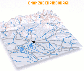 Places with similar names to Emāmzādeh Pīr Bodāgh, Iran :: Disclaimer :: Information on this page comes without warranty of any kind |
||
|
Where is Emāmzādeh Pīr Bodāgh? Elevation and coordinates ::
Latitude (lat): 32°22'0"N Longitude (lon): 48°57'0"E
Elevation (approx.): 261m (map arrows pan, magnifying glasses zoom) |
||
|
Visiting Emāmzādeh Pīr Bodāgh? Hotel/Accommodation ::
Book a hotel in Emāmzādeh Pīr Bodāgh Travel Guide ::
Buy a travel guide for Iran rental cars ::
car rental offers GPS waypoint ::
download a GPX waypoint (PoI) of Emāmzādeh Pīr Bodāgh for your GPS receiver
|
||