|
search place name
|
||
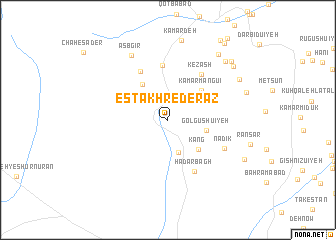
Estakhr-e Derāz (Kermān, Iran)Estakhr-e Derāz is a town in the Kermān region of Iran. An overview map of the region around Estakhr-e Derāz is displayed below.
regional and 3d topo map of Estakhr-e Derāz, Iran ::
Estakhr-e Derāz airports ::
The nearest airport is AZD - Yazd Shahid Sadooghi, located 179.3 km north of Estakhr-e Derāz.
Other airports nearby include KER - Kerman (188.1 km east), Nearby towns ::
Kahtūkorhā (3.8km south) //
Golgūshū'īyeh (3.9km east) //
Kang (4.4km south east) //
Zārū'īyeh-ye Pā'īn (4.6km north west) //
Kamar Mangū'ī (4.6km north east) //
Kamar Sefīd-e Pā'īn (6.1km north) //
Zārū'īyeh-ye Bālā (6.1km north west) //
Kezash (6.0km north east) //
Hādar Bāgh (6.3km south east) //
Nadīk (6.4km south east) //
Asb Gīr (8.0km north west) //
Kamar Deh (8.9km north) //
Deh Now (8.6km north east) //
Mehr-e Pā'īn (8.1km east) //
Tangāleh (8.3km north east) //
Mūrpahn (8.8km north east) //
Behnūā Pā'īn (8.6km north east) //
Kāshkū'īyeh (8.6km south east) //
Bīnavā (8.9km north east) //
Mūreyn (10.1km north east) //
Deh-e Shādū'īyeh (10.2km north east) //
[all distances 'as the bird flies' and approximate]  Places with similar names to Estakhr-e Derāz, Iran ::
// Estakhr-e Derāz (IR)
Disclaimer :: Information on this page comes without warranty of any kind |
||
|
Where is Estakhr-e Derāz? Elevation and coordinates ::
Latitude (lat): 30°24'47"N Longitude (lon): 55°0'5"E
Elevation (approx.): 2238m (map arrows pan, magnifying glasses zoom) |
||
|
Visiting Estakhr-e Derāz? Hotel/Accommodation ::
Book a hotel in Estakhr-e Derāz Travel Guide ::
Buy a travel guide for Iran rental cars ::
car rental offers GPS waypoint ::
download a GPX waypoint (PoI) of Estakhr-e Derāz for your GPS receiver
|
||