|
search place name
|
||
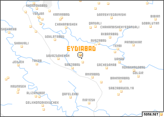
‘Eydīābād (Khūzestān, Iran)‘Eydīābād is a town in the Khūzestān region of Iran. An overview map of the region around ‘Eydīābād is displayed below.
regional and 3d topo map of ‘Eydīābād, Iran ::
‘Eydīābād airports ::
The nearest airport is QMJ - Masjed Soleiman Shahid Asyaee, located 24.5 km north west of ‘Eydīābād.
Other airports nearby include AWZ - Ahwaz (78.3 km south west), MRX - Bandar Mahshahr Mahshahr (140.0 km south), ABD - Abadan (193.2 km south west), BSR - Basrah Intl (215.0 km south west), Nearby towns ::
Fatḩābād (0.9km south) //
Sabzābād (2.8km south west) //
‘Avaẕābād (4.0km north east) //
Amīrābād (4.9km south east) //
‘Avazābād (4.7km north east) //
Davāzdah Emām (4.6km west) //
Gach-e Dam Āb (5.4km south east) //
Ḩoseynābād (6.7km south east) //
Chūb-e Sorkh (7.3km north) //
Dowlatābād (6.7km north west) //
Tambīān (6.6km east) //
Chahār Bīsheh (7.7km north west) //
Qand ‘Alī (7.8km north) //
Akbarābād (7.3km north east) //
Tembī (7.3km east) //
Dam Ab (7.4km east) //
Khvājehābād (9.8km north west) //
Bahrāmābād (9.2km south east) //
Chahār Bīsheh-ye Qand ‘Alī (9.8km north east) //
Sabzābād-e Soflá (10.9km south east) //
[all distances 'as the bird flies' and approximate] 
Disclaimer :: Information on this page comes without warranty of any kind |
||
|
Where is ‘Eydīābād? Elevation and coordinates ::
Latitude (lat): 31°48'12"N Longitude (lon): 49°22'54"E
Elevation (approx.): 414m (map arrows pan, magnifying glasses zoom) |
||
|
Visiting ‘Eydīābād? Hotel/Accommodation ::
Book a hotel in ‘Eydīābād Travel Guide ::
Buy a travel guide for Iran rental cars ::
car rental offers GPS waypoint ::
download a GPX waypoint (PoI) of ‘Eydīābād for your GPS receiver
|
||