|
search place name
|
||
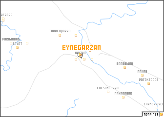
‘Eyn-e Garzān (Īlām, Iran)‘Eyn-e Garzān is a town in the Īlām region of Iran. An overview map of the region around ‘Eyn-e Garzān is displayed below.
regional and 3d topo map of ‘Eyn-e Garzān, Iran ::
‘Eyn-e Garzān airports ::
The nearest airport is AWZ - Ahwaz, located 185.1 km south east of ‘Eyn-e Garzān.
Other airports nearby include QMJ - Masjed Soleiman Shahid Asyaee (187.2 km east), KSH - Bakhtaran Shahid Ashrafi Esfahani (203.7 km north), BSR - Basrah Intl (220.0 km south), MRX - Bandar Mahshahr Mahshahr (275.1 km south east), Nearby towns ::
Emām Seyyed Ḩoseyn (0.4km south east) //
Mūsīān (0.5km north west) //
Godār (1.2km west) //
Kiyād Hurda (2.0km east) //
Patak (2.4km north east) //
Marzābād (5.5km north) //
Tappeh Qor'ān (6.9km north west) //
Cheshmeh Rabī‘ (9.2km south east) //
[all distances 'as the bird flies' and approximate] 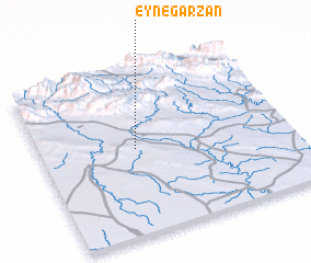 Places with similar names to ‘Eyn-e Garzān, Iran :: Disclaimer :: Information on this page comes without warranty of any kind |
||
|
Where is ‘Eyn-e Garzān? Elevation and coordinates ::
Latitude (lat): 32°31'7"N Longitude (lon): 47°22'45"E
Elevation (approx.): 138m (map arrows pan, magnifying glasses zoom) |
||
|
Visiting ‘Eyn-e Garzān? Hotel/Accommodation ::
Book a hotel in ‘Eyn-e Garzān Travel Guide ::
Buy a travel guide for Iran rental cars ::
car rental offers GPS waypoint ::
download a GPX waypoint (PoI) of ‘Eyn-e Garzān for your GPS receiver
|
||