|
search place name
|
||
‘Eyn ol Qāş (Ostān-e Kermānshāh, Iran)‘Eyn ol Qāş is a town in the Ostān-e Kermānshāh region of Iran. An overview map of the region around ‘Eyn ol Qāş is displayed below.
regional and 3d topo map of ‘Eyn ol Qāş, Iran ::

‘Eyn ol Qāş airports ::
The nearest airport is KSH - Bakhtaran Shahid Ashrafi Esfahani, located 48.2 km west of ‘Eyn ol Qāş.
Other airports nearby include SDG - Sanandaj (106.8 km north west), Nearby towns ::
Derkeh (0.3km south east) //
Sarāsīāb (1.9km south) //
Shāhsavan (2.4km north west) //
Gāvdāneh Godār (2.4km south west) //
Sīāh Choqā (3.7km south) //
‘Alī Gorzān-e ‘Olyā (3.1km west) //
Elāyīyeh (4.0km north) //
Deh-e Morādkhān (3.6km north east) //
Şaḩneh (4.3km north east) //
Darvīshān (4.6km east) //
Kalvasar (5.6km north) //
Charkhāb (5.6km south) //
Kalīdar (4.9km east) //
Argeneh-ye ‘Olyā (5.9km south) //
Argeneh-ye Soflá (5.8km south) //
Hāshemābād (5.4km west) //
Mīr ‘Azīzī (6.0km west) //
‘Āmeleh (7.1km south) //
‘Alī Gorzān-e Soflá (6.1km west) //
Qeshlāq-e Kelīd Darreh (6.4km east) //
‘Alīābād (6.4km east) //
Dowlatābād (6.4km west) //
Hemmatābād (7.2km north east) //
‘Alīābād-e Garūs (7.2km south east) //
Kāvūs (8.0km north) //
Āb Bārīk (7.7km north west) //
‘Amārat (8.4km south) //
Choqā Lā'ī (8.7km north east) //
‘Abbāsābād (10.1km north west) //
[all distances 'as the bird flies' and approximate] 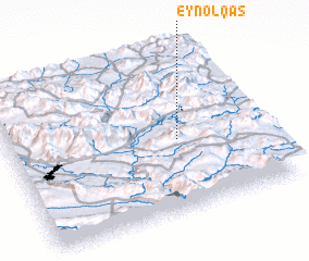 Places with similar names to ‘Eyn ol Qāş, Iran :: Disclaimer :: Information on this page comes without warranty of any kind |
||
|
Where is ‘Eyn ol Qāş? Elevation and coordinates ::
Latitude (lat): 34°27'0"N Longitude (lon): 47°40'0"E
Elevation (approx.): 1304m (map arrows pan, magnifying glasses zoom) |
||
|
Visiting ‘Eyn ol Qāş? Hotel/Accommodation ::
Book a hotel in ‘Eyn ol Qāş Travel Guide ::
Buy a travel guide for Iran rental cars ::
car rental offers GPS waypoint ::
download a GPX waypoint (PoI) of ‘Eyn ol Qāş for your GPS receiver
|
||