|
search place name
|
||
Farkharān (Ostān-e Āz̄arbāyjān-e Sharqī, Iran)Farkharān is a town in the Ostān-e Āz̄arbāyjān-e Sharqī region of Iran. An overview map of the region around Farkharān is displayed below.
regional and 3d topo map of Farkharān, Iran ::

Farkharān airports ::
The nearest airport is TBZ - Tabriz Intl, located 49.4 km south west of Farkharān.
Nearby towns ::
Lejen (1.5km south east) //
Baḩr-e Beyg (1.8km north) //
Şīfār (2.4km south west) //
Avīlaq (2.8km north) //
Ūlīq (3.6km north) //
Dāshkasan (2.9km east) //
Vardīn (3.4km south east) //
Rostamābād (3.4km north west) //
Dardīn (4.0km south) //
Lambarān (3.5km west) //
Kūr Bolāgh (4.3km south west) //
Kohnehlū (4.7km north east) //
Āb Khvāreh (4.7km south east) //
Āgh Bolāgh-e ‘Olyā (4.8km south west) //
Alahrod (6.2km south) //
Mazra‘eh-ye Shādī (7.4km north) //
Savāreh (6.1km south west) //
Āqā Bābā-ye Frāmarzī (6.1km east) //
Homā-ye Pāʼīn (6.2km west) //
Bāgh Bolāgh-e Bālā (6.2km west) //
Moshīrābād (7.6km south) //
Mazra‘eh-ye Gol (6.8km north west) //
Homā-ye Bālā (7.0km south west) //
Galū (8.6km north west) //
Ḩammāmlū (8.1km south east) //
Sorkheh Dīzaj (9.3km north east) //
Qareh Bolāgh (9.7km south east) //
[all distances 'as the bird flies' and approximate] 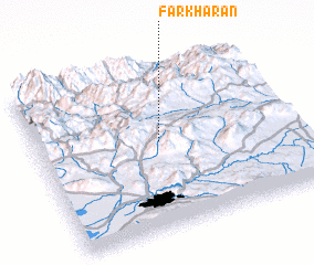 Places with similar names to Farkharān, Iran :: Disclaimer :: Information on this page comes without warranty of any kind |
||
|
Where is Farkharān? Elevation and coordinates ::
Latitude (lat): 38°32'2"N Longitude (lon): 46°29'2"E
Elevation (approx.): 1810m (map arrows pan, magnifying glasses zoom) |
||
|
Visiting Farkharān? Hotel/Accommodation ::
Book a hotel in Farkharān Travel Guide ::
Buy a travel guide for Iran rental cars ::
car rental offers GPS waypoint ::
download a GPX waypoint (PoI) of Farkharān for your GPS receiver
|
||