|
search place name
|
||
Fashārūd (Iran)Fashārūd is a town in Iran. An overview map of the region around Fashārūd is displayed below.
regional and 3d topo map of Fashārūd, Iran ::

Fashārūd airports ::
The nearest airport is QMJ - Masjed Soleiman Shahid Asyaee, located 209.2 km south west of Fashārūd.
Nearby towns ::
Shāqū (1.1km south) //
Shahr-e Mīzān (1.4km west) //
Mīān Rūdān (1.5km west) //
Qāsemābād (1.5km east) //
Qal‘eh-ye Moḩammad Beyk (1.5km east) //
Robāţ-e Morād (1.8km south west) //
Nafīs (2.0km east) //
Bāgh Mīr (2.4km south east) //
Ḩoseynābād (2.7km north east) //
Aznowjān (2.8km north west) //
Qeydū (3.6km south east) //
Hastījān (3.6km north west) //
Mazāyen (4.0km south east) //
Godār (4.4km east) //
Yamn (4.6km west) //
Zavarqān (5.0km north west) //
Jalmājerd-e Jadīd (4.9km east) //
Mahestān (5.0km east) //
Robāţ-e Morād (5.3km south west) //
Shūreh-ye Pā'īn (6.4km north east) //
Shūreh-ye Bālā (6.6km north east) //
Amīnābād (6.4km west) //
Yārdel Āghāj (7.2km north west) //
Vāpīleh (9.2km north west) //
[all distances 'as the bird flies' and approximate] 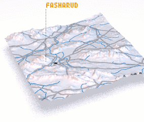 Places with similar names to Fashārūd, Iran ::
// Vyshhorod (UA)
// Ghāshirdia (BD)
Disclaimer :: Information on this page comes without warranty of any kind |
||
|
Where is Fashārūd? Elevation and coordinates ::
Latitude (lat): 33°41'0"N Longitude (lon): 50°17'0"E
Elevation (approx.): 1684m (map arrows pan, magnifying glasses zoom) |
||
|
Visiting Fashārūd? Hotel/Accommodation ::
Book a hotel in Fashārūd Travel Guide ::
Buy a travel guide for Iran rental cars ::
car rental offers GPS waypoint ::
download a GPX waypoint (PoI) of Fashārūd for your GPS receiver
|
||