|
search place name
|
||
Fedīj (Kermān, Iran)Fedīj is a town in the Kermān region of Iran. An overview map of the region around Fedīj is displayed below.
regional and 3d topo map of Fedīj, Iran ::

Fedīj airports ::
The nearest airport is KER - Kerman, located 144.2 km east of Fedīj.
Other airports nearby include AZD - Yazd Shahid Sadooghi (203.5 km north west), Nearby towns ::
Dehū'īyeh (0.5km south east) //
Rashvān (0.7km south west) //
Manşūrābād (1.4km east) //
Fatḩābād (1.8km east) //
Estāhū'īyeh (2.4km south west) //
Jūjeh Now (2.4km west) //
Rāvīz (2.5km south west) //
Mehjerdī (2.9km south west) //
Darreh Anjīr (2.9km north east) //
Shādīābād (2.7km east) //
Tall-e Bolūr (3.1km north west) //
Deh-e Esmā‘īl (3.1km south east) //
Jalālābād (3.7km south) //
Jīsū'īyeh (3.3km north west) //
Ḩūm od Dīn (3.3km west) //
Tall-e Sorkh (3.4km west) //
Kūh-e Sorkh (4.4km north) //
Bandebān (3.9km west) //
Mahājerī (4.0km west) //
Sahmābād (4.3km east) //
Darreh Kerdī (4.6km north west) //
Pākash (4.7km west) //
Sīrāb (4.7km east) //
Nīmjerdū'īyeh (5.2km south west) //
Samrāyeh (6.2km south west) //
Jadal Tanān (6.5km north west) //
Bahres (6.3km east) //
Qāsemīyeh (6.5km north west) //
Rūdīn (6.4km west) //
[all distances 'as the bird flies' and approximate] 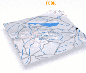 Places with similar names to Fedīj, Iran ::
Disclaimer :: Information on this page comes without warranty of any kind |
||
|
Where is Fedīj? Elevation and coordinates ::
Latitude (lat): 30°22'34"N Longitude (lon): 55°27'24"E
Elevation (approx.): 2168m (map arrows pan, magnifying glasses zoom) |
||
|
Visiting Fedīj? Hotel/Accommodation ::
Book a hotel in Fedīj Travel Guide ::
Buy a travel guide for Iran rental cars ::
car rental offers GPS waypoint ::
download a GPX waypoint (PoI) of Fedīj for your GPS receiver
|
||