|
search place name
|
||
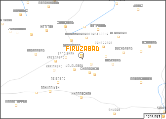
Fīrūzābād (Khorāsān, Iran)Fīrūzābād is a town in the Khorāsān region of Iran. An overview map of the region around Fīrūzābād is displayed below.
regional and 3d topo map of Fīrūzābād, Iran ::
Nearby towns ::
Maḩmūdīyeh (0.8km north) //
Z̄abīḩābād (1.9km south east) //
Jalālābād (2.8km south west) //
Cherāgh Chī (3.2km south east) //
Shahrābād (3.0km north west) //
Kūsheh (3.5km north east) //
Zangī Shāh (3.2km west) //
‘Abdolābād (4.0km south east) //
Moḩammadābād-e Dast Goshā (4.9km north) //
Khorramābād (4.8km north west) //
Dowlatābād (4.3km east) //
Z̧āherābāb (4.8km north east) //
Kāz̧emābād (5.1km west) //
Naşrābād (5.6km east) //
Karīmābād (5.9km south west) //
Kalāteh-ye Now (7.4km north) //
Seyfābād (7.2km north) //
‘Azīzābād (6.9km south west) //
Zīrakābād (8.0km north west) //
Kharāb Chāh (8.5km south) //
‘Alī Ābādak (8.2km north east) //
Rahmānīyeh (9.5km south west) //
Ḩaţīţeh (9.4km north west) //
[all distances 'as the bird flies' and approximate]  Places with similar names to Fīrūzābād, Iran ::
Disclaimer :: Information on this page comes without warranty of any kind |
||
|
Where is Fīrūzābād? Elevation and coordinates ::
Latitude (lat): 35°7'35"N Longitude (lon): 57°57'11"E
Elevation (approx.): 879m (map arrows pan, magnifying glasses zoom) |
||
|
Visiting Fīrūzābād? Hotel/Accommodation ::
Book a hotel in Fīrūzābād Travel Guide ::
Buy a travel guide for Iran rental cars ::
car rental offers GPS waypoint ::
download a GPX waypoint (PoI) of Fīrūzābād for your GPS receiver
|
||