|
search place name
|
||
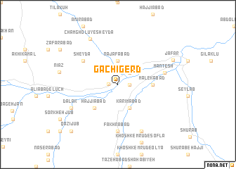
Gachī Gerd (Kordestān, Iran)Gachī Gerd is a town in the Kordestān region of Iran. An overview map of the region around Gachī Gerd is displayed below.
regional and 3d topo map of Gachī Gerd, Iran ::
Gachī Gerd airports ::
The nearest airport is SDG - Sanandaj, located 56.4 km west of Gachī Gerd.
Other airports nearby include KSH - Bakhtaran Shahid Ashrafi Esfahani (123.7 km south), Nearby towns ::
Bāy Tamer (1.2km west) //
‘Abbāsābād (1.5km east) //
Farhādābād (2.4km north east) //
Najafābād (3.7km north) //
Karīmābād (4.0km south) //
Ḩājjīābād (4.8km south west) //
Malekābād (4.5km east) //
Sheydā (5.9km north west) //
Fakhrābād (7.4km south) //
Mantesh (6.3km east) //
‘Alīābād-e Yālghūz Āghāj (8.0km south) //
Dalak (7.1km south west) //
Chamgholū-ye Sheydā (8.0km north west) //
Ja‘far (8.1km north east) //
Qāẕī Jūb (9.6km south west) //
[all distances 'as the bird flies' and approximate] 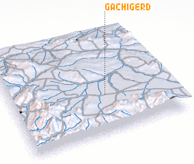 Places with similar names to Gachī Gerd, Iran ::
// Gach Gerd (IR)
Disclaimer :: Information on this page comes without warranty of any kind |
||
|
Where is Gachī Gerd? Elevation and coordinates ::
Latitude (lat): 35°24'0"N Longitude (lon): 47°36'0"E
Elevation (approx.): 1719m (map arrows pan, magnifying glasses zoom) |
||
|
Visiting Gachī Gerd? Hotel/Accommodation ::
Book a hotel in Gachī Gerd Travel Guide ::
Buy a travel guide for Iran rental cars ::
car rental offers GPS waypoint ::
download a GPX waypoint (PoI) of Gachī Gerd for your GPS receiver
|
||