|
search place name
|
||
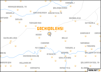
Gachī Qal‘ehsī (Ostān-e Āz̄arbāyjān-e Sharqī, Iran)Gachī Qal‘ehsī is a town in the Ostān-e Āz̄arbāyjān-e Sharqī region of Iran. An overview map of the region around Gachī Qal‘ehsī is displayed below.
regional and 3d topo map of Gachī Qal‘ehsī, Iran ::
Gachī Qal‘ehsī airports ::
The nearest airport is SDG - Sanandaj, located 136.8 km south of Gachī Qal‘ehsī.
Other airports nearby include TBZ - Tabriz Intl (191.7 km north), Nearby towns ::
Īncheh (2.4km north east) //
Bāghcheh Mīsheh (3.5km north west) //
Champān (4.0km south) //
Ḩeşār (3.4km west) //
Şafīyār Khān (4.8km north east) //
Bolūz (4.8km east) //
Feyẕābād (6.3km south west) //
Tark Darreh (5.8km north west) //
Khazā'ī-ye ‘Olyā (7.6km north) //
Āyākhchī (7.9km south) //
Ḩamzeh Qāsem (8.0km north) //
Qāshoq (8.7km south east) //
Tandarlū (8.2km south east) //
Khvosh Qeshlāq (10.4km south west) //
[all distances 'as the bird flies' and approximate] 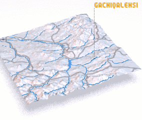 Places with similar names to Gachī Qal‘ehsī, Iran ::
// Kachī Qal‘ehsī (IR)
Disclaimer :: Information on this page comes without warranty of any kind |
||
|
Where is Gachī Qal‘ehsī? Elevation and coordinates ::
Latitude (lat): 36°28'0"N Longitude (lon): 46°48'0"E
Elevation (approx.): 1994m (map arrows pan, magnifying glasses zoom) |
||
|
Visiting Gachī Qal‘ehsī? Hotel/Accommodation ::
Book a hotel in Gachī Qal‘ehsī Travel Guide ::
Buy a travel guide for Iran rental cars ::
car rental offers GPS waypoint ::
download a GPX waypoint (PoI) of Gachī Qal‘ehsī for your GPS receiver
|
||