|
search place name
|
||
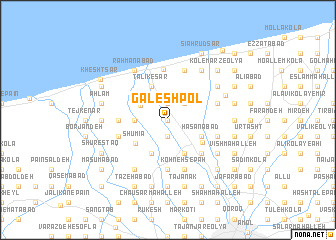
Gālesh Pol (Iran)Gālesh Pol is a town in Iran. An overview map of the region around Gālesh Pol is displayed below.
regional and 3d topo map of Gālesh Pol, Iran ::
Gālesh Pol airports ::
The nearest airport is THR - Teheran Mehrabad Intl, located 132.2 km south west of Gālesh Pol.
Other airports nearby include RZR - Ramsar (147.7 km west), Nearby towns ::
Jūneh Kolā (0.0km north) //
Khvordūn Kolā (0.0km north) //
Gīlāpey (1.9km south) //
Tarsīāb (1.9km north) //
Sīār Kolā (1.9km north) //
Ormak Kolā (2.4km north east) //
Āzādmūn (3.0km north west) //
Yūsefābād (3.0km west) //
Telāram (4.0km south) //
Qaşşāb Kotī (4.0km south) //
Mīr Alamdeh (4.0km south) //
Ḩasanābād (3.5km south east) //
Talīk-e Sar (4.0km north) //
Kharāb Maḩalleh (4.0km north) //
Ābād Maḩalleh (4.0km north) //
Shūmīā (4.0km south west) //
Kolū Deh (4.0km south east) //
Karchak-e Navā'ī (4.8km south east) //
Nāmūs Deh (4.8km south east) //
Geleyerd (5.6km south) //
Būndeh-e Pā'īn (4.5km west) //
Maḩmūdābād (5.7km north) //
‘Eshqābād (4.8km south east) //
Nāşerābād (4.8km south east) //
Būndeh-e Bālā (4.8km south west) //
Būlīdeh (5.8km south) //
Ḩarabdeh (5.8km north) //
Kohneh Sepāh (5.8km south) //
Āram (4.8km north east) //
[all distances 'as the bird flies' and approximate]  Places with similar names to Gālesh Pol, Iran :: Disclaimer :: Information on this page comes without warranty of any kind |
||
|
Where is Gālesh Pol? Elevation and coordinates ::
Latitude (lat): 36°35'0"N Longitude (lon): 52°17'0"E
Elevation (approx.): -7m (map arrows pan, magnifying glasses zoom) |
||
|
Visiting Gālesh Pol? Hotel/Accommodation ::
Book a hotel in Gālesh Pol Travel Guide ::
Buy a travel guide for Iran rental cars ::
car rental offers GPS waypoint ::
download a GPX waypoint (PoI) of Gālesh Pol for your GPS receiver
|
||