|
search place name
|
||
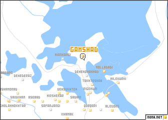
Gamshād (Sīstān va Balūchestān, Iran)Gamshād is a town in the Sīstān va Balūchestān region of Iran. An overview map of the region around Gamshād is displayed below.
regional and 3d topo map of Gamshād, Iran ::
Gamshād airports ::
The nearest airport is ZAH - Zahedan Intl, located 223.1 km south of Gamshād.
Nearby towns ::
Deh-e Moḩammad (3.6km south) //
Mīān Kangī (4.0km west) //
Mollā Dādī (4.6km south east) //
Takht-e Shāh (5.8km south) //
Rīg-e Mūrī (7.4km south) //
Deh-e Heybat (7.7km south) //
Deh Sūkhteh (8.1km south west) //
Mīl-e Kurkī (8.2km south east) //
Maḩmūdī-ye Bālā (8.8km south east) //
Ās-e Ḩājjī (8.8km south west) //
Deh-e Mollā Dādī (8.9km south east) //
[all distances 'as the bird flies' and approximate] 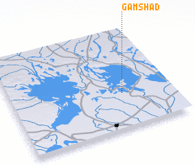 Places with similar names to Gamshād, Iran ::
// Kamashady (RU)
// Kamyshata (RU)
// Kamyshet (RU)
// Kamyshet (RU)
// Kamyshta (RU)
// Kamyshta (RU)
// Kamysh-Tau (RU)
// Guamachito (CO)
// Guamachito (VE)
// Guamachito (VE)
Disclaimer :: Information on this page comes without warranty of any kind |
||
|
Where is Gamshād? Elevation and coordinates ::
Latitude (lat): 31°22'0"N Longitude (lon): 61°42'0"E
Elevation (approx.): 478m (map arrows pan, magnifying glasses zoom) |
||
|
Visiting Gamshād? Hotel/Accommodation ::
Book a hotel in Gamshād Travel Guide ::
Buy a travel guide for Iran rental cars ::
car rental offers GPS waypoint ::
download a GPX waypoint (PoI) of Gamshād for your GPS receiver
|
||