|
search place name
|
||
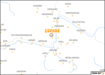
Garm Āb (Iran)Garm Āb is a town in Iran. An overview map of the region around Garm Āb is displayed below.
regional and 3d topo map of Garm Āb, Iran ::
Garm Āb airports ::
The nearest airport is THR - Teheran Mehrabad Intl, located 40.1 km south of Garm Āb.
Other airports nearby include RZR - Ramsar (110.4 km north west), RAS - Rasht (207.3 km north west), Nearby towns ::
Sorkheh Darreh (0.0km north) //
Meydānak (0.0km north) //
Oshtorak (1.5km east) //
Ḩasanak Dar (1.9km north) //
Sorkhdar (1.5km east) //
Malek Fālīz (3.7km north) //
Kasīl (3.4km south east) //
Nesā' Pā`īn (3.7km north east) //
Hamehjā (3.6km south west) //
Tangeh Kasīl (4.0km south) //
Dardeh (4.6km south west) //
Gowdar (5.4km south) //
Gashnādar (4.8km south east) //
Gowdar (5.7km south) //
Kashgūn (4.9km east) //
Āsīāb Dargāh (5.8km north) //
Emām Cheshmeh (5.8km north) //
Kūshkak (5.8km north) //
Shāh Pol (5.8km north) //
Gach Sar (6.0km north) //
Valeh (6.1km north) //
Sarak (6.2km south) //
Shelnak (6.0km south) //
Nesā'-e Pā'īn (5.8km north east) //
Lānīz (6.9km south) //
Kīāsar (6.3km west) //
Kohneh Deh (7.6km north) //
Kolārūd (6.3km east) //
Derāz Mīān (6.3km east) //
[all distances 'as the bird flies' and approximate] 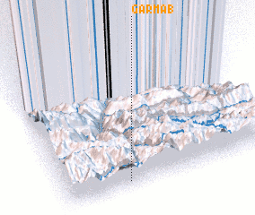 Places with similar names to Garm Āb, Iran ::
Disclaimer :: Information on this page comes without warranty of any kind |
||
|
Where is Garm Āb? Elevation and coordinates ::
Latitude (lat): 36°3'0"N Longitude (lon): 51°18'0"E
Elevation (approx.): 2334m (map arrows pan, magnifying glasses zoom) |
||
|
Visiting Garm Āb? Hotel/Accommodation ::
Book a hotel in Garm Āb Travel Guide ::
Buy a travel guide for Iran rental cars ::
car rental offers GPS waypoint ::
download a GPX waypoint (PoI) of Garm Āb for your GPS receiver
|
||