|
search place name
|
||
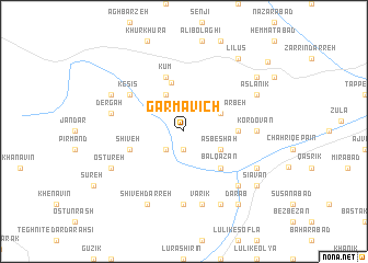
Garmāvīch (Ostān-e Āz̄arbāyjān-e Sharqī, Iran)Garmāvīch is a town in the Ostān-e Āz̄arbāyjān-e Sharqī region of Iran. An overview map of the region around Garmāvīch is displayed below.
regional and 3d topo map of Garmāvīch, Iran ::
Garmāvīch airports ::
The nearest airport is VAN - Van, located 111.4 km west of Garmāvīch.
Other airports nearby include TBZ - Tabriz Intl (150.7 km east), Nearby towns ::
Barqazan (1.9km south) //
Shenātāl (2.4km south west) //
Māteh Kharbeh (3.5km north east) //
Asbeshah (3.5km south east) //
Keshkāvīch (4.0km north) //
Kūzeh Rash (5.1km north) //
Balqazān (4.7km south east) //
Kahrīz (4.4km east) //
Kūm (5.7km north) //
Shīveh (4.8km south west) //
Kesīs (5.7km north west) //
Kordovān (5.8km east) //
Jang-e Sar (7.4km south) //
Varīk (7.6km south) //
Dergah (6.1km west) //
Lakābād (7.1km south east) //
Aşlānīk (6.9km north east) //
Askābād (6.9km south east) //
Ḩājjī Jafān (6.9km north west) //
Elyāsī (8.0km south) //
Ostūreh (6.9km south west) //
Shīvādar (8.0km south) //
Shīveh Darreh (8.0km south) //
Zangū (8.1km north east) //
Sīāvān (8.1km south east) //
Līlūs (8.6km north east) //
Dārāb (8.6km south east) //
Āgh Bolāgh (9.7km north east) //
[all distances 'as the bird flies' and approximate]  Places with similar names to Garmāvīch, Iran ::
Disclaimer :: Information on this page comes without warranty of any kind |
||
|
Where is Garmāvīch? Elevation and coordinates ::
Latitude (lat): 38°6'0"N Longitude (lon): 44°31'0"E
Elevation (approx.): 2021m (map arrows pan, magnifying glasses zoom) |
||
|
Visiting Garmāvīch? Hotel/Accommodation ::
Book a hotel in Garmāvīch Travel Guide ::
Buy a travel guide for Iran rental cars ::
car rental offers GPS waypoint ::
download a GPX waypoint (PoI) of Garmāvīch for your GPS receiver
|
||