|
search place name
|
||
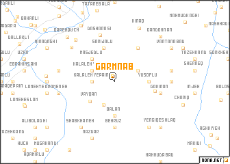
Garmnāb (Kermān, Iran)Garmnāb is a town in the Kermān region of Iran. An overview map of the region around Garmnāb is displayed below.
regional and 3d topo map of Garmnāb, Iran ::
Garmnāb airports ::
The nearest airport is TBZ - Tabriz Intl, located 101.5 km south west of Garmnāb.
Nearby towns ::
Kalāleh-ye Pāʼīn (2.9km west) //
Kalāleh-ye Bālā (3.4km north west) //
Āyenehlū (4.0km south) //
Alherd (3.4km north east) //
Vāyqān (4.5km south west) //
Masjedlū (4.7km north west) //
Bālān (5.6km south) //
Yūsoflū (4.3km east) //
Aḩmadlū (5.7km north) //
Qareh Tīkānlū (5.7km north) //
Sārījālū (5.7km north) //
Sheykh Ḩoseynlū (6.3km north east) //
‘Abbāsābād (5.3km east) //
Behrūz (7.4km south) //
Gavīrān (6.1km east) //
Dāsh Ārāsī (7.8km north) //
‘Āsheqlū (7.9km north west) //
Shab Khāneh (8.6km south west) //
Kolashlū (8.6km south east) //
Setan (8.5km north west) //
Vīnaq (9.3km north) //
Yengī Qeshlāq (9.4km south east) //
Gandom Nān (9.4km north east) //
Qareh Qūch (9.5km north west) //
[all distances 'as the bird flies' and approximate]  Places with similar names to Garmnāb, Iran ::
// Keur Maniabé (SN)
// Krummennaab (DE)
Disclaimer :: Information on this page comes without warranty of any kind |
||
|
Where is Garmnāb? Elevation and coordinates ::
Latitude (lat): 38°56'0"N Longitude (lon): 46°48'0"E
Elevation (approx.): 1225m (map arrows pan, magnifying glasses zoom) |
||
|
Visiting Garmnāb? Hotel/Accommodation ::
Book a hotel in Garmnāb Travel Guide ::
Buy a travel guide for Iran rental cars ::
car rental offers GPS waypoint ::
download a GPX waypoint (PoI) of Garmnāb for your GPS receiver
|
||