|
search place name
|
||
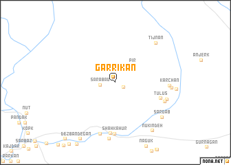
Garrīkān (Sīstān va Balūchestān, Iran)Garrīkān is a town in the Sīstān va Balūchestān region of Iran. An overview map of the region around Garrīkān is displayed below.
regional and 3d topo map of Garrīkān, Iran ::
Garrīkān airports ::
The nearest airport is ZBR - Chah Bahar, located 174.2 km south west of Garrīkān.
Other airports nearby include TRB - Turbo Turbat Intl (183.0 km south east), GWD - Gwadar (190.2 km south east), PSI - Pasni (252.2 km south east), Nearby towns ::
Kūsh (1.4km south east) //
Sarābād (2.3km west) //
Pīr (3.7km north east) //
Tūlūs (7.0km east) //
Shāh Kahūr (8.3km south) //
Kandez (8.3km south) //
Naskand (7.9km south east) //
Mītakān (8.6km south) //
Kalleh Gūk (8.0km east) //
Kārchān (7.9km east) //
Tīj Nān (8.7km north east) //
Sard Āb (8.9km south east) //
Nūkīn Deh (9.5km south east) //
[all distances 'as the bird flies' and approximate] 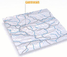 Places with similar names to Garrīkān, Iran ::
Disclaimer :: Information on this page comes without warranty of any kind |
||
|
Where is Garrīkān? Elevation and coordinates ::
Latitude (lat): 26°43'33"N Longitude (lon): 61°23'25"E
Elevation (approx.): 1127m (map arrows pan, magnifying glasses zoom) |
||
|
Visiting Garrīkān? Hotel/Accommodation ::
Book a hotel in Garrīkān Travel Guide ::
Buy a travel guide for Iran rental cars ::
car rental offers GPS waypoint ::
download a GPX waypoint (PoI) of Garrīkān for your GPS receiver
|
||